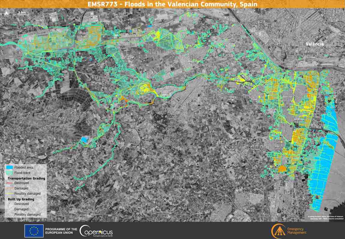
Extensive destruction and the tragic loss of over 200 lives have resulted from severe flash floods which struck the Community of Valencia, Spain, on 29 October 2024. As of 4 November, recovery operations continue in previously inaccessible areas in the region.

The Copernicus Emergency Management Service (CEMS) has been activated (EMSR773) to deliver assessments of the extent of the flooding and its impacts in affected areas.
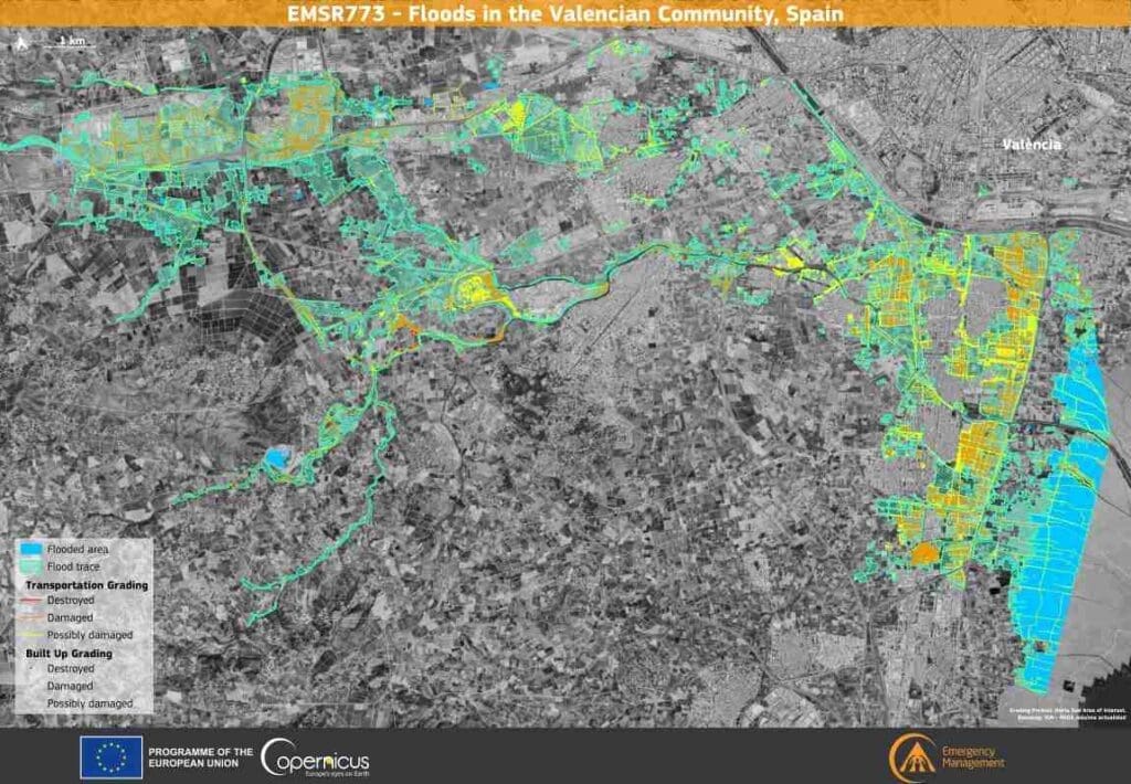
copernic Horta Sud res
Credit: European Union, Copernicus Sentinel-2 imagery

This data visualisation, based on CEMS data, depicts the situation in the ‘Horta Sud’ Area of Interest (a small part of a larger monitoring effort being conducted by CEMS) on 31 October at 10:22 UTC.

The map reveals that more than 4,100 hectares of surface and 3,906 buildings have been affected by flooding, while more than 60,000 people, 15.2 km of railways, and 531.6 km of roads were potentially impacted. More information is available here.

The information provided by CEMS is key to more efficient emergency response and future mitigation strategies for extreme weather events.

Featured image credit: European Union, Copernicus Sentinel-2 imagery

Image: man using laptop
Leading healthy, sustainable lives is all fun and gamesNews

Leading healthy, sustainable lives is all fun and games

Nishtha Phutela | BML Munjal University in Haryana - By using an engaging format and features such as a scoreboard and rewards, games can help…
SourceSourceDecember 31, 2024 Full article
Satellite Images: Mikoszewo, Poland
Image of the day: Baltic currents build new shoreline near MikoszewoNews

Image of the day: Baltic currents build new shoreline near Mikoszewo

A new beach has formed along Poland’s northern coast, where the Vistula River empties into the Gulf of Gdańsk. Located near the village of Mikoszewo,…
Muser NewsDeskMuser NewsDeskApril 11, 2025 Full article
Satellite Image: Puntarenas, Costa Rica
Image of the day: Rising seas threaten the narrow coast of PuntarenasNews

Image of the day: Rising seas threaten the narrow coast of Puntarenas

Puntarenas, Costa Rica stretches along a slim finger of land jutting into the Pacific, clearly visible in this Copernicus Sentinel-2 image captured on 20 March…
Muser NewsDeskMuser NewsDeskJune 6, 2025 Full article