For the first time, satellite missions from ESA and NASA have united to provide a detailed picture of the dramatic changes occurring in the Greenland Ice Sheet.
This collaboration, hailed as a major breakthrough in polar science, has allowed researchers to accurately track changes in the ice sheet’s thickness using data from CryoSat-2 and ICESat-2, the two agencies’ flagship ice-monitoring satellites.
A new study, led by researchers at the UK Centre for Polar Observation and Modelling (CPOM) at Northumbria University and published in Geophysical Research Letters, confirms that measurements from the two satellites align with an unprecedented accuracy of within 3%. This agreement paves the way for combining their data, enhancing the precision of ice loss estimates, and providing vital information for understanding and responding to climate change.
Since 2010, Greenland’s ice sheet has thinned by an average of 1.2 meters, with thinning reaching over 6.4 meters in the ice sheet’s margins. The most extreme changes were observed at major outlet glaciers, where thinning exceeded 67 meters at Sermeq Kujalleq (Jakobshavn Isbræ) and 75 meters at Zachariae Isstrøm. In total, the ice sheet lost 2,347 cubic kilometers of ice between 2010 and 2023 – enough to fill Lake Victoria, Africa’s largest lake.
The study revealed that Greenland’s ice loss peaked during the scorching summers of 2012 and 2019, when over 400 cubic kilometers of ice melted each year. This loss not only contributes significantly to global sea level rise but also disrupts weather patterns and ocean circulation, with widespread consequences for ecosystems and communities worldwide.
The unique capabilities of CryoSat-2 and ICESat-2 were key to this achievement. CryoSat-2’s radar altimeter measures surface height by penetrating ice and snow, while ICESat-2’s laser altimeter provides surface-level precision. By synchronizing their orbits during the ESA-NASA Cryo2ice campaign, scientists collected near-simultaneous radar and laser data, enabling accurate measurements of snow depth and ice thickness.
Nitin Ravinder, lead author of the study and CPOM researcher, emphasized the significance of the findings. “We are very excited to have discovered that CryoSat-2 and ICESat-2 are in such close agreement. Their complementary nature provides a strong motivation to combine the data sets to produce improved estimates of ice sheet volume and mass changes,” Ravinder said. “As ice sheet mass loss is a key contributor to global sea level rise, this is incredibly useful for the scientific community and policymakers.”
Tommaso Parrinello, CryoSat Mission Manager at ESA, highlighted the impact of the collaboration: “By aligning our data with ICESat-2, we’ve opened new avenues for precision and insight. This collaboration represents an exciting step forward, not just in terms of technology but in how we can better serve scientists and policymakers who rely on our data to understand and mitigate climate impacts.”
Thorsten Markus, project scientist for ICESat-2 mission at NASA, echoed this enthusiasm, noting how the collaboration ensures a consistent picture of Greenland’s changes. “Understanding the similarities and differences between radar and lidar ice sheet height measurements allows us to fully exploit the complementary nature of those satellite missions,” Markus said. “Studies like this are critical to put a comprehensive time series of the ICESat, CryoSat-2, ICESat-2, and, in the future, CRISTAL missions together.”
This partnership highlights the importance of international collaboration in understanding and responding to climate challenges. CPOM, comprising six universities and the British Antarctic Survey, plays a key role in observing and modeling polar region changes, equipping policymakers to address future impacts.
Journal Reference:
Nitin Ravinder, Andrew Shepherd, Inès Otosaka, Thomas Slater, Alan Muir, Lin Gilbert, ‘Greenland Ice Sheet Elevation Change From CryoSat-2 and ICESat-2’, Geophysical Research Letters 51, 24, e2024GL110822 (2024). DOI: 10.1029/2024GL110822
Article Source:
Press Release/Material by Northumbria University | CPOM
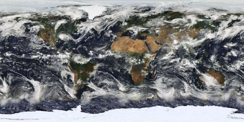
Featured image Greenland Ice Sheet. Credit: Prof Andrew Shepherd | Northumbria University