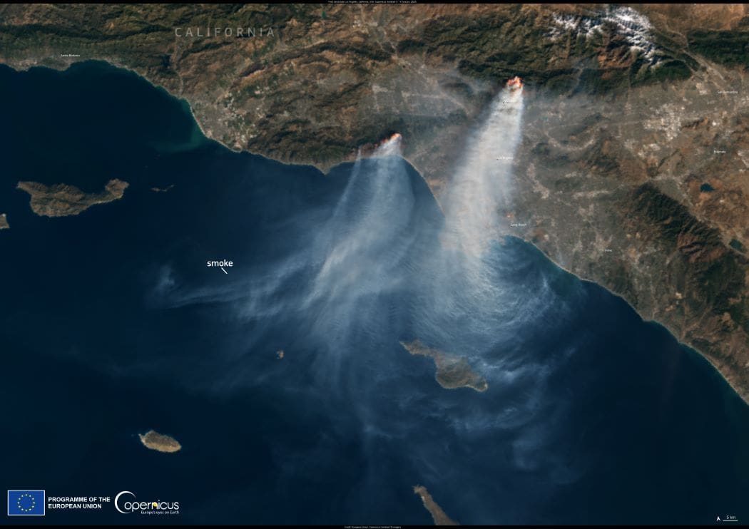
A ferocious wildfire broke out in the Hollywood Hills of Los Angeles, California, on January 7, 2025, threatening famous landmarks and densely populated neighborhoods. The blaze is one of four major wildfires in the area that have led to significant loss of life and property.

At least five people have died, more than 2,000 structures have been destroyed, and over 130,000 residents have been evacuated. By January 8, authorities declared a state of emergency, with power outages leaving more than 456,000 people in the dark.
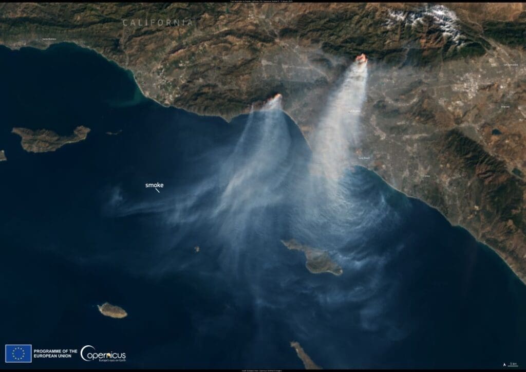
Satellite image of wildfire of Los Angeles, California
California, USA. Credit: European Union, Copernicus Sentinel-3 imagery

This dramatic scene, captured by the Copernicus Sentinel-3 satellite on January 9, 2025, shows the widespread devastation.

Open data from Sentinel satellites is invaluable for monitoring wildfires, mapping their extent, and aiding disaster response efforts worldwide.

Featured image credit: European Union, Copernicus Sentinel-3 imagery

EarthCARE satellite to probe how clouds affect climate
Image: Artist's view of EarthCARE satellite on board a Falcon 9 launch vehicle
EarthCARE satellite to probe how clouds affect climateClimateNews

EarthCARE satellite to probe how clouds affect climate

By Patrick T. FALLON with Juliette COLLEN in Paris | AFP Vandenberg Air Force Base, United States (UPDATED) - A rocket carrying a sophisticated satellite…
SourceSourceMay 29, 2024 Full article
Serbia government greenlights disputed lithium mining project
Image: a close up of a rock formation with rocks in the background
Serbia government greenlights disputed lithium mining projectNews

Serbia government greenlights disputed lithium mining project

Belgrade, Serbia (AFP) - The Serbian government on Tuesday gave permission to restart operations at a disputed Rio Tinto lithium mining project, days after a…
SourceSourceJuly 16, 2024 Full article
NASA satellite data highlight the cooling effect of green spaces in urban areas
Landsat 8 satellite captured this natural color image of Sanaa, Yemen, on June 8, 2024. Sanaa
NASA satellite data highlight the cooling effect of green spaces in urban areasNewsScience

NASA satellite data highlight the cooling effect of green spaces in urban areas

NASA Data Reveals Role of Green Spaces in Cooling Cities During a heatwave, the comfort of a shady tree is a luxury that many urban…
SourceSourceNovember 27, 2024 Full article