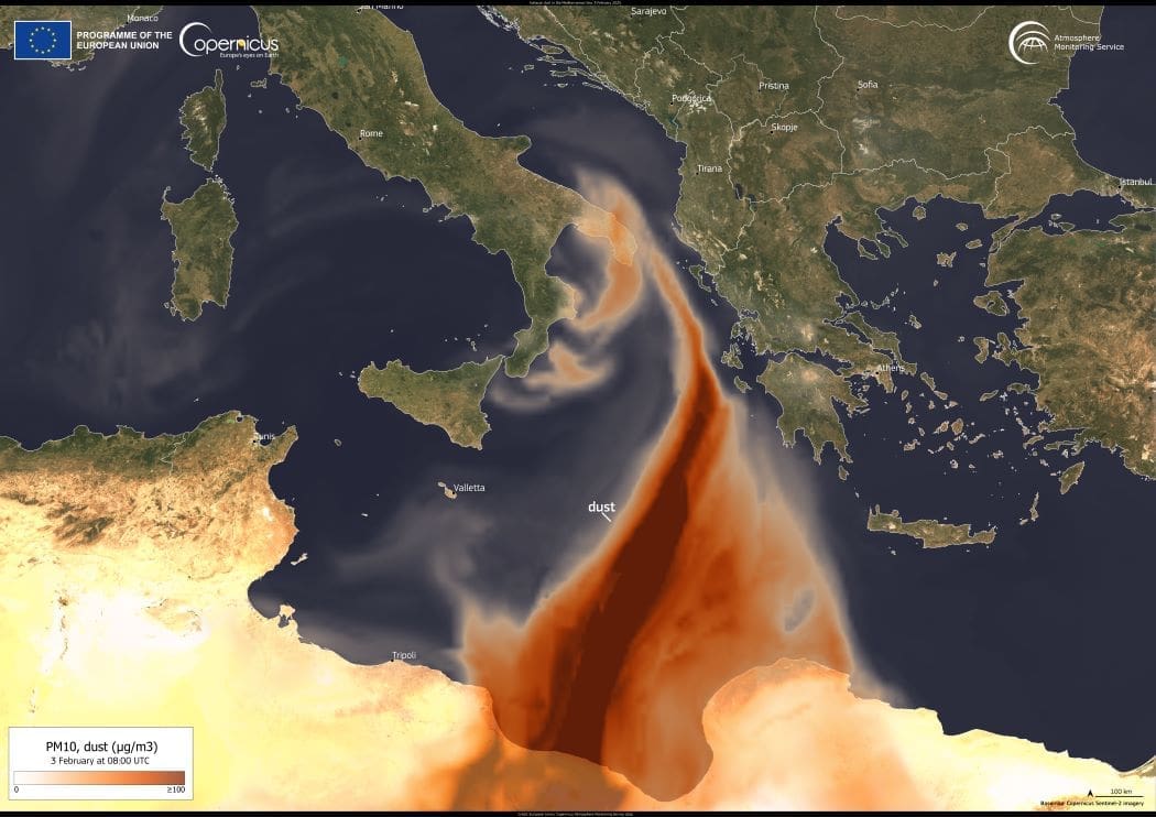
On 2 February 2025, strong winds carried a vast cloud of Saharan dust across the Mediterranean, reaching southern Italy. The phenomenon, driven by a cyclone originating in North Africa, caused skies over Sicily and Calabria to take on a yellowish hue, affecting air quality and visibility.
Satellite image: Mediterranean Sea
Mediterranean Sea. Credit: European Union, Copernicus Atmosphere Monitoring Service Data

By the following day, the dust plume continued eastward toward Greece. A visualization from the Copernicus Atmosphere Monitoring Service (CAMS), based on data from 3 February at 8:00 UTC, captures the movement of the airborne particles southeast of Italy as they approached Greece.

CAMS provides global air quality monitoring and forecasts, tracking atmospheric pollutants and aerosols to help communities respond to such events.

Featured image credit: European Union, Copernicus Atmosphere Monitoring Service Data

Image of the day: February 2025 was the third warmest on record
Image: Surface Air Temperature Anomaly for February 2025 (°C) (s. Climate Change)
Image of the day: February 2025 was the third warmest on recordNewsFacts

Image of the day: February 2025 was the third warmest on record

The Copernicus Climate Change Service (C3S) reports that February 2025 was the third warmest February recorded globally, with an average surface air temperature of 13.36°C.…
Muser NewsDeskMuser NewsDeskMarch 11, 2025 Full article
US warns of China-Russia cooperation in Arctic
Image: Water, Mountains in background
US warns of China-Russia cooperation in ArcticClimateNews

US warns of China-Russia cooperation in Arctic

Washington, United States (AFP) - The US Defense Department warned Monday of increasing Russian-Chinese collaboration in the Arctic, as climate change opens the region to…
SourceSourceJuly 23, 2024 Full article
Image of the day: The impact of the floods south of Valencia, Spain
Satellite Images: Floods in Spain
Image of the day: The impact of the floods south of Valencia, SpainNews

Image of the day: The impact of the floods south of Valencia, Spain

This data visualisation compares two Copernicus Sentinel-2 satellite acquisitions over the area south of Valencia, Spain, captured on 26 and 31 October 2024, before and…
SourceSourceNovember 2, 2024 Full article