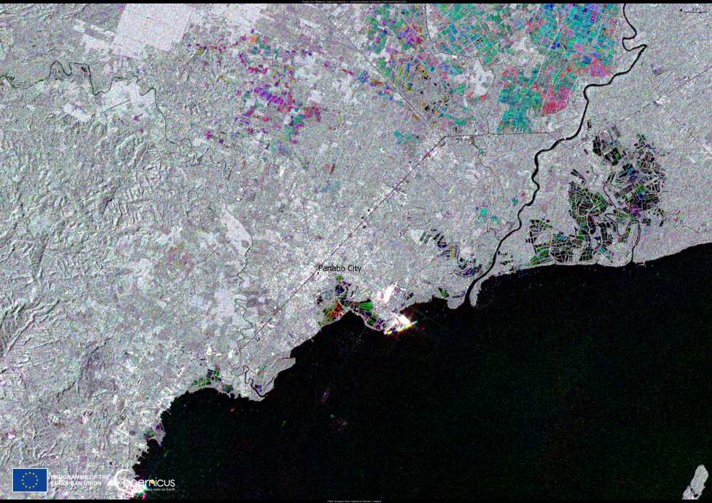
The Philippines, one of the most disaster-prone countries in the world, faces increasing risks from environmental pressures, including ground subsidence. This phenomenon, which causes gradual sinking of the ground, poses a major threat to urban areas by exacerbating flooding, damaging infrastructure, and intensifying storm surges.
A recent study from the University of the Philippines, published in the International Journal of Applied Earth Observation and Geoinformation, identifies Panabo City, located in Metro Davao, as experiencing the highest rate of subsidence in the country, with an annual sinking rate of 38 millimeters.
Researchers link this subsidence to fishponds and industrial activities in the area. The study also highlights significant subsidence beneath a chemical manufacturing facility in Bunawan, as well as near the Davao River in Talomo and Buhangin. Other affected areas include residential and commercial zones close to the coastline in Poblacion and Talomo.

This image was produced by combining data from the Copernicus Sentinel-1A satellite between December 2024 and March 2025. At the center of the image, Panabo City stands out as the most affected area by ground subsidence.
The Copernicus Sentinel satellites provide critical data to monitor subsidence and other environmental challenges, assisting authorities in designing more sustainable urban planning strategies. Through the EU’s Global Gateway strategy, the European Commission and the European Space Agency (ESA) are supporting the establishment of the Copernicus Data Centre in the Philippines.
This initiative (The CopPhil Centre), in partnership with the Philippine Space Agency (PhilSA) and the Department of Science & Technology, aims to enhance the country’s access to Copernicus data, aiding climate resilience, biodiversity conservation, and hazard management. Among its key activities, the centre includes a pilot service dedicated to ground motion monitoring.
Featured image credit: European Union, Copernicus Sentinel-1 imagery


