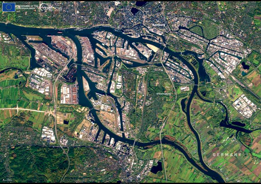
Germany’s second-largest city, Hamburg, is both an economic powerhouse and one of Europe’s busiest maritime hubs. The city’s vast port stretches along the Elbe River and is deeply integrated into Hamburg’s urban fabric. South of the main harbor lies Wilhelmsburg, a distinctive quarter shaped by the river’s many channels. Known for its blend of industrial zones, green spaces, and residential areas, Wilhelmsburg also plays a central role in Hamburg’s flood protection strategy.

This Copernicus Sentinel-2 image, acquired on 25 October 2024, shows the Port of Hamburg in detail, with its dense array of container terminals and shipping docks lining the Elbe. Wilhelmsburg appears in the southern section of the image, surrounded by water and crisscrossed by infrastructure designed to manage rising flood risks — a growing concern as northern Germany faces more frequent storm surges and heavier rainfall.
Wilhelmsburg’s role in Hamburg’s flood resilience reflects broader efforts to adapt urban environments to the challenges of climate change. The district’s location makes it particularly vulnerable, but also well-positioned as a testing ground for innovative infrastructure and sustainable urban planning.
Open satellite data from the Copernicus program supports these efforts, providing essential information for monitoring land use, guiding development, and managing environmental risks. For cities like Hamburg, tools like Sentinel-2 imagery help ensure that growth and resilience can go hand in hand.
Featured image credit: European Union, Copernicus Sentinel-2 imagery


