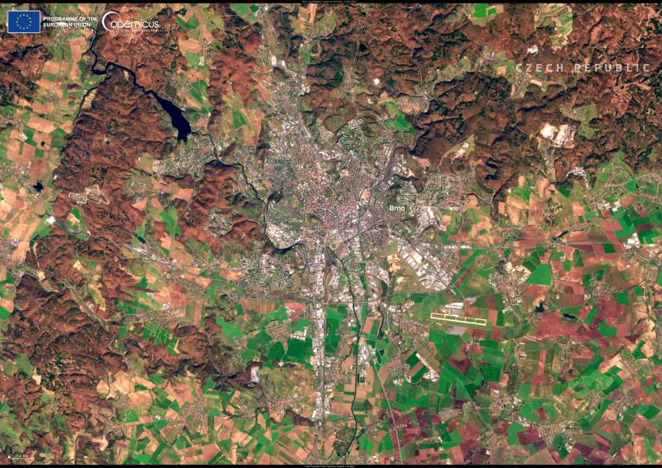
Brno, the Czech Republic’s second-largest city, is a place where historic charm, urban development, and surrounding wilderness blend into a striking landscape. A recent image from the Copernicus Sentinel-2 satellite, captured on 4 April 2025, offers a vivid snapshot of this balance – with the city nestled amid agricultural plots, patches of forest, and rolling hills.
From above, Brno appears as a dense urban mosaic flanked by the geometry of farmland and the organic shapes of nearby woodlands. The view reflects the city’s position at the crossroads of modern expansion and environmental stewardship. While the urban core pulses with economic and cultural activity, the outskirts are laced with natural features that are integral to the region’s identity.

To the northeast lies the Moravian Karst, one of the Czech Republic’s most valuable protected landscapes. Part of the EU’s Natura 2000 network, this karst region is home to more than 1,000 caves and a network of subterranean rivers, making it one of Europe’s notable speleological sites. The area supports a rich array of species and has been shaped over millennia by the region’s geological forces.
The satellite image highlights more than just beauty – it’s part of a broader mission to track changes in land use, guide sustainable development, and protect natural resources. The Sentinel-2 program, operated by the European Union’s Copernicus initiative, plays a critical role in monitoring urban sprawl, deforestation, crop patterns, and environmental pressures.
With cities like Brno expanding and the surrounding countryside adapting to modern agricultural demands, tools like Sentinel-2 data are key to understanding and managing the interface between urban life and the ecosystems that surround it.
Featured image credit: European Union, Copernicus Sentinel-2 imagery


