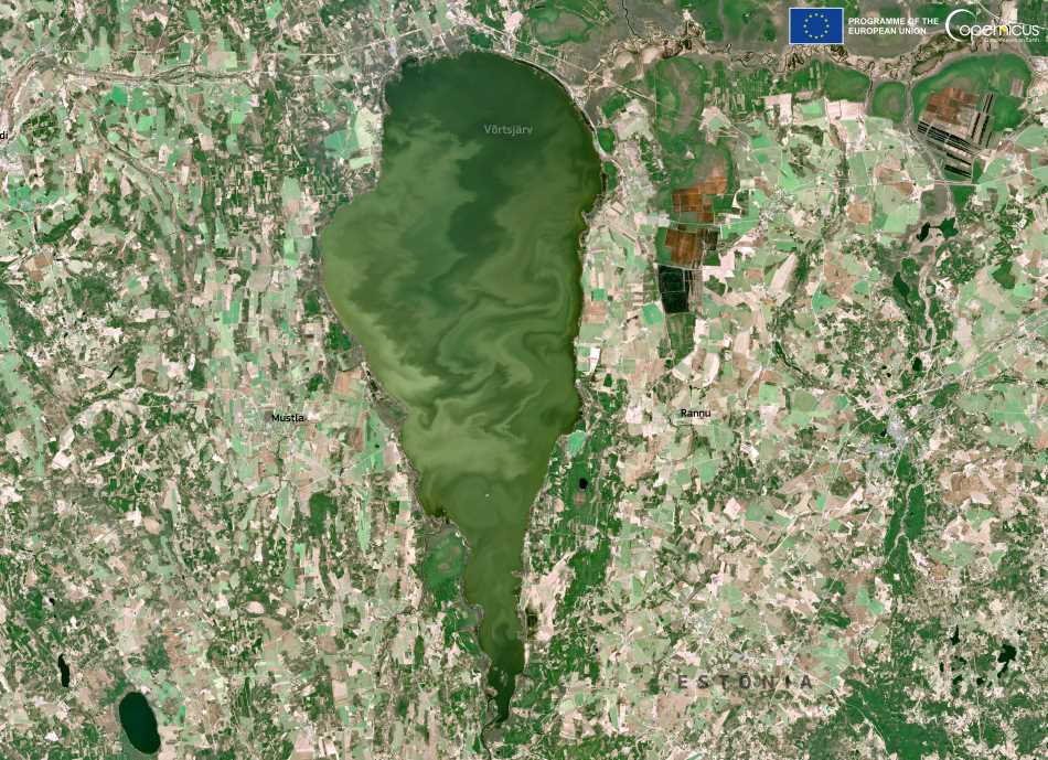
Lake Võrtsjärv, one of Estonia’s great inland waters, is revealed in this 13 April 2025 Copernicus Sentinel-2 image as it begins to thaw from winter. The lake, covering more than 270 square kilometers, lies in the country’s southeast and is the second largest in Estonia. Visible swirls of green across its surface mark the seasonal inflow of suspended sediments — fine particles washed in by melting snow and ice from surrounding farmland. Wind-driven mixing in the lake’s shallow basin enhances this striking visual effect.
Beyond its scenic appeal, Lake Võrtsjärv is a vital ecological zone. It supports 213 bird species, 138 of which are known to breed in the area. Reeds, meadows, and gravel shores provide key habitat, while its location makes it an important resting and feeding site for migratory birds. The lake has been proposed as a Special Protection Area (SPA) and a Special Area of Conservation (SAC) under the EU’s Natura 2000 framework. Several species listed in the EU Birds Directive, including the Eurasian bittern (Botaurus stellaris), depend on its habitats.

Fish diversity is another hallmark of the lake’s ecosystem. The European eel (Anguilla anguilla), whose migration route spans from Võrtsjärv to the Sargasso Sea, is emblematic of this connection. Other species — such as Silurus glanis, Coregonus albula, and Aspius aspius — are classified under Estonia’s Red Data Book due to their vulnerability or declining populations. Some of the lake’s tributaries also support rare and protected species like the weatherfish (Misgurnus fossilis) and spined loach (Cobitis taenia).
But this biodiversity is under threat. Agricultural runoff and inadequate wastewater treatment feed nutrient loads into the lake, fueling eutrophication and algal blooms. Climate change adds further stress by reducing winter ice cover and increasing water temperatures, conditions that exacerbate ecological imbalance. Conservation initiatives led by the Võrtsjärv Centre and the Limnological Centre promote awareness and sustainable use, aiming to reconcile human activity with ecological resilience.
Monitoring from Sentinel-2 satellites enables scientists to track these evolving conditions. Observing sediment dynamics, vegetation shifts, and surface characteristics over time helps inform both research and policy, supporting the long-term health of one of Estonia’s most important freshwater ecosystems.
Featured image credit: European Union, Copernicus Sentinel-2 imagery


