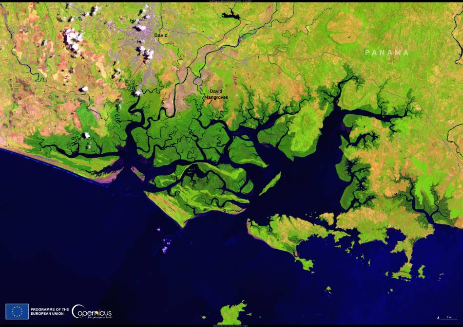
Along the Pacific coastline of western Panama lies a rich and resilient ecosystem known as the David Mangroves, or Manglares de David. Covering approximately 26,600 hectares, these mangroves form a natural shield for the city of David, buffering its coastline against erosion, storm surges, and the intensifying impacts of climate change. But their significance extends far beyond protection — they serve as nurseries for marine species, critical habitat for migratory birds, and carbon-rich zones vital for climate regulation.
Visible in this Copernicus Sentinel-2 image acquired on 16 April 2025, the David Mangroves spread out along tidal inlets and estuarine zones, revealing the complex structure of a healthy mangrove system interwoven with Panama’s coastal development.

The Copernicus Sentinel satellites are an essential tool for monitoring ecosystems like these. Through high-resolution, multi-spectral imaging, Sentinel-2 provides ongoing data on mangrove health, extent, and degradation — insights that are indispensable for conservation efforts and policy decisions. These data streams are freely accessible, enabling scientists, governments, and NGOs to track changes and take action quickly in the face of threats such as deforestation, pollution, or sea-level rise.
Panama also plays a leading role in promoting satellite data for sustainable development. The country hosts the CopernicusLAC Panama Centre, a regional hub advancing the use of Earth observation technologies in Latin America and the Caribbean. Launched through the EU-LAC Digital Alliance and implemented by the European Space Agency with the support of Panama’s government, the centre works to increase resilience across the region by enhancing access to geospatial data and training. From disaster management to environmental protection, the initiative is part of the broader EU Global Gateway strategy aiming to bridge digital and environmental priorities.
By capturing the David Mangroves from space, this image not only highlights one of Panama’s key ecological treasures but also reflects the growing role of open-access Earth observation in safeguarding natural systems throughout the tropics.
Featured image credit: European Union, Copernicus Sentinel-2 imagery


