Nestled in the eastern Pyrenees between France and Spain, Andorra is a country defined by its mountains. With a total area of just 468 square kilometers, it is one of the smallest states in Europe, yet its steep terrain, deep valleys, and high-altitude villages offer dramatic scenery and a distinct cultural identity. Andorra’s official language is Catalan, and its history and institutions reflect centuries of influence from both neighboring powers.
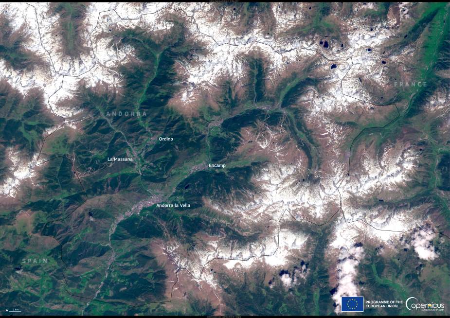
This Copernicus Sentinel-2 image, acquired on 21 May 2025, shows Andorra in striking detail. Clearly visible in the center are the country’s main urban hubs: Andorra la Vella, the capital and highest capital city in Europe; La Massana, known for its ski resorts; Encamp, a key transport and cultural center; and Ordino, rich in architectural heritage. These towns are tightly nestled within the steep valleys that cut through the mountainous landscape, with narrow roads winding through the rugged topography.

The international borders of Andorra are also discernible in the image — Spain lies to the southwest and France to the northeast. The country’s geography has long shaped its development, from its role as a strategic mountain pass to its present-day popularity as a tourism destination. Visitors come year-round for skiing, hiking, and mountain biking, and its duty-free status adds to its appeal.
Open-access data from the Copernicus Sentinel satellites is increasingly used to monitor regions like Andorra, where mountainous terrain presents both ecological richness and management challenges. Satellite imagery helps track land use, forest health, snow cover, and the impacts of climate change, supporting informed decisions on development and conservation in fragile alpine environments.
Featured image credit: European Union, Copernicus Sentinel-2 imagery


