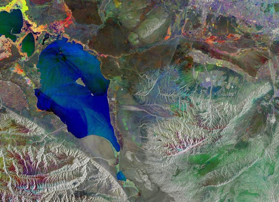
Seasonal changes in eastern Kazakhstan paint a vivid picture in this radar image of Lake Alakol, captured by the Copernicus Sentinel-1 mission using false-colour processing to reveal ground changes from March to May 2025.
The lake’s name, Alakol, meaning “multicoloured lake”, is especially fitting here. Located near the border with China, it appears in the top left in shifting shades of blue and green, reflecting variations in its frozen saltwater surface across three acquisition dates. Each radar image, taken a month apart, was assigned a distinct colour: March in blue, April in green, and May in red. Overlapping them highlights change, while areas that remained stable appear white or grey.

Two smaller lakes — Koshkarkol and part of Sasykkol — lie to the northwest. The surrounding land glows in pink, yellow and magenta hues, showing how vegetation evolved in spring. This dynamic area is part of the Alakol–Sasykkol lake system, a Ramsar-designated wetland and UNESCO Biosphere Reserve that supports vital bird populations like Dalmatian Pelicans and Greater Flamingos.
The radar image also reveals a striking alluvial fan to the west, shaped by runoff from the Dzungarian Alatau mountains. These runoff patterns leave behind fertile soils, forming colourful agricultural plots in a distinctive triangular formation.
Lake Alakol lies along the Dzhungarian Gate, a wide valley pass through the Dzungarian Alatau range. This corridor has long connected Central Asia to China, and today, it continues to shape both the landscape and the region’s ecology.
Featured image credit: contains modified Copernicus Sentinel data (2025), processed by ESA | ESA Standard Licence


