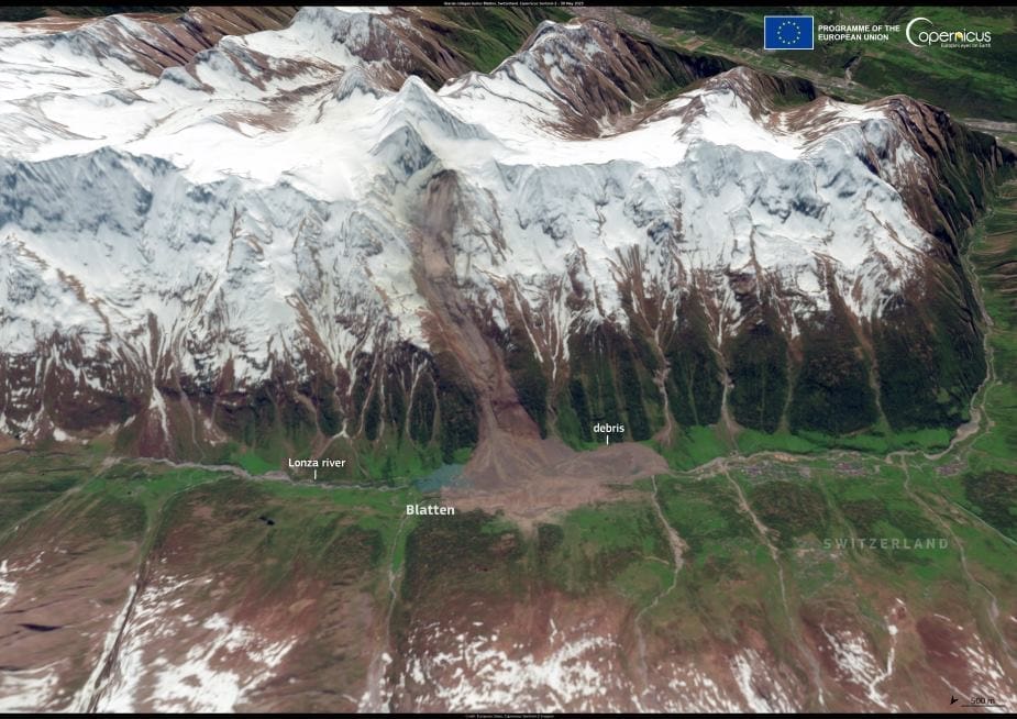
A catastrophic glacial collapse in the Swiss Alps triggered a massive landslide on 28 May 2025, engulfing much of the village of Blatten in the Lötschental valley. Around 3 million cubic metres of debris thundered down from the Birch Glacier, destroying nearly 90% of the village’s structures and reshaping the landscape below.
The event has sparked fears of further hazards, as the landslide blocked the Lonza River, forming a natural dam. Authorities are now closely monitoring water levels in the valley amid warnings of potential flooding.
This Copernicus Sentinel-2 image, captured on 30 May 2025, shows the scar of the collapse cutting through the alpine terrain. The brownish-grey trail of earth and rock stands in stark contrast to the surrounding green meadows and lingering snowfields, marking the destructive path taken by the debris flow.

The incident underscores the growing threat of glacial instability in a warming climate. As temperatures rise, glaciers across the Alps are retreating and becoming more prone to collapse. According to Switzerland’s Federal Office for the Environment, Copernicus satellite data is a critical resource for monitoring glacier conditions and identifying structural changes that may signal increased risk.
While emergency services continue to assess damage and monitor for secondary disasters, scientists warn that this may not be an isolated event. Ongoing satellite observation and early warning systems remain vital tools in protecting lives and infrastructure in vulnerable mountain regions.
Featured image credit: European Union, Copernicus Sentinel-2 imagery


