International collaborations leverage MBARI’s expertise and advanced technology to better understand polar ecosystems
This year marks the opening of the United Nations Decade of Action for Cryospheric Sciences, an international initiative focused on the rapid changes occurring in glaciers, snow cover, ice sheets, sea ice, and permafrost and their impacts on the planet. MBARI’s cutting-edge research and technology will play a critical role in this effort, providing important data about the Arctic seafloor and the Southern Ocean.
“Ice-covered ocean and land are integral to the health of our planet and host unique communities of life. The Decade of Action for Cryospheric Sciences provides an opportunity to collaborate to better understand and protect these critically important polar environments. As a leader in ocean science and engineering, MBARI is well-positioned to play a major role in international efforts to take the pulse of polar regions and help discovery in uncharted waters,” said MBARI President and CEO Antje Boetius, a global leader in polar research.

Snapshots of MBARI’s work in the Arctic and Southern Ocean
Investigating changes to the Arctic seafloor
Scientists have only recently been able to access the seafloor at the edge of the Canadian Arctic due to climate change impacts on sea ice.
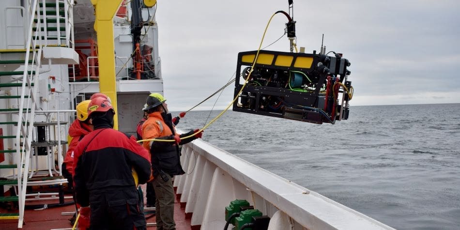
Researchers have used MBARI’s autonomous underwater vehicles to conduct mapping surveys of the seafloor in this region, revealing remarkably complex underwater terrain. Data show dynamic and dramatic changes to the seafloor caused by the melting of ancient submerged permafrost as well as current cycles of melting and freezing seawater. MBARI’s research can help guide policymakers’ decisions about underwater infrastructure in the Arctic. This summer, MBARI researchers will return to the Canadian Beaufort Sea to continue this work.
MBARI’s collaborators on this body of work include researchers at the Geological Survey of Canada, Fisheries and Oceans Canada, the Korean Polar Research Institute, and the US Naval Research Laboratory.
Monitoring carbon and climate in the Southern Ocean
MBARI is part of the Southern Ocean Carbon and Climate Observations and Modeling (SOCCOM) project, an international, multi-institutional effort to help researchers better understand the Southern Ocean, one of the most challenging regions to study on the planet.
SOCCOM uses robotic BGC-Argo floats with advanced sensors developed by MBARI researchers to continuously log data about ocean conditions, including chemistry and productivity. There are currently more than 100 SOCCOM floats operating in the Southern Ocean. SOCCOM data are publicly available, allowing researchers around the world to access this remote part of the world. MBARI also leads SOCCOM’s outreach efforts, including a program to bring live data from SOCCOM’s robotic floats to the classroom.
Studying seafloor processes in Antarctica
The flow of water from the seafloor to the ocean at the land-sea interface—known as submarine groundwater discharge—plays an important role in ocean biogeochemistry, marine ecology, and seafloor geology. This process has been challenging to study in Antarctica, where climate change is likely causing fresh to brackish water to leak from the seafloor.
MBARI researchers are working to quantify submarine groundwater discharge along the Antarctic Peninsula and understand its environmental impacts. Preliminary findings suggest submarine groundwater discharge occurs at a higher rate in Antarctica than at similar depths in temperate environments, and this research will help refine future climate models at regional scales.
Assessing the biodiversity of the Southern Ocean
Environmental DNA (eDNA) allows scientists to detect the presence of organisms from the tiny bits of genetic material—cells, skin, waste, and mucus—they leave behind. eDNA provides a powerful tool for assessing the biodiversity of aquatic environments.
MBARI’s Environmental Sample Processor (ESP) and Filtering Instrument for DNA Observations (FIDO) allow researchers to collect and study eDNA in remote environments. Earlier this year, MBARI, in collaboration with the Australian Antarctic Program, sent ESP and FIDO instruments on the research icebreaker Nuyina on an expedition to the Denman Glacier region in East Antarctica to evaluate applications for this eDNA technology in the Southern Ocean.
Article Source:
Press Release/Material by Monterey Bay Aquarium Research Institute
Featured image credit: Dave Caress | MBARI


