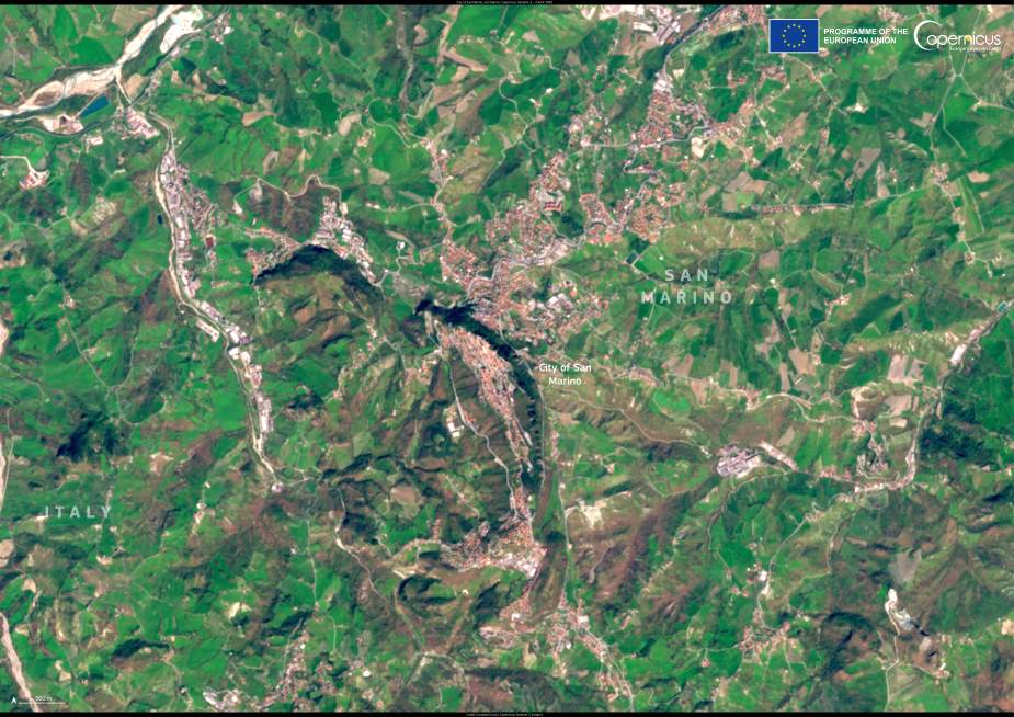
San Marino, one of the world’s oldest and smallest republics, appears in this Copernicus Sentinel-2 satellite image acquired on 4 April 2025. The tiny landlocked state, measuring just over 60 square kilometers, lies entirely within central Italy between the regions of Emilia-Romagna and Marche. Despite its size, San Marino has maintained its independence for over 17 centuries — longer than nearly any other existing state.
According to the official San Marino government and European institutions, the republic was founded in the year 301 A.D. by a Christian stonemason named Marinus, who fled persecution under the Roman Emperor Diocletian. He established a small monastic community on Mount Titano, which later evolved into the independent republic that bears his name. Today, San Marino is a parliamentary republic with its own constitution, government, and institutions, and it maintains diplomatic relations with many countries around the world.

The capital, also named San Marino, sits atop Mount Titano and retains a striking medieval character. The historic city is known for its narrow stone streets, fortified towers, and defensive walls. In 2008, UNESCO inscribed “San Marino Historic Centre and Mount Titano” as a World Heritage site, recognizing its preservation of centuries-old architecture and symbolic importance as a testament to civic liberty and continuity.
In this satellite image, the layout of the capital can be seen atop the ridge of Mount Titano, while surrounding agricultural fields and rolling hills form a patchwork across the landscape. The Copernicus Sentinel-2 mission provides high-resolution imagery that is used to monitor changes to both natural and cultural landscapes. Its data are valuable not only for tracking environmental shifts, but also for helping preserve historically significant sites such as San Marino.
Featured image credit: European Union, Copernicus Sentinel-2 imagery


