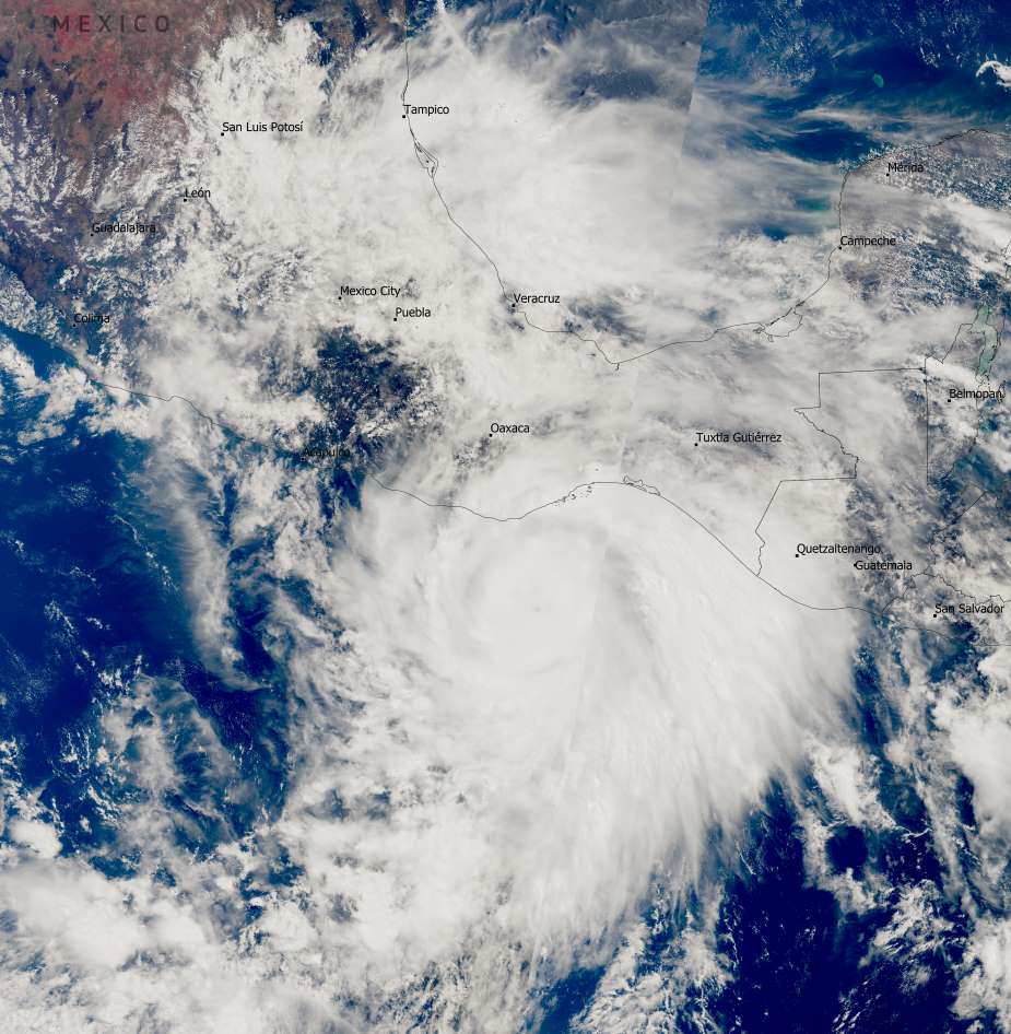
Hurricane Erick formed in the Pacific Ocean on 17 June 2025 and quickly intensified, becoming a Category 4 hurricane with sustained winds reaching up to 230 km/h. As it moved closer to the Mexican coast, the storm weakened slightly, but still retained significant strength. By 19 June, Erick made landfall near Pinotepa Nacional in Oaxaca as a Category 3 hurricane, bringing winds of around 200 km/h, heavy rain, and storm surges. One fatality has been reported, and authorities are continuing damage assessments in affected areas.
This Copernicus Sentinel-3 image, acquired on 18 June, captures Hurricane Erick swirling just offshore as it approached Mexico.

The storm’s rapid intensification and large size posed a serious threat to coastal communities in southern Mexico. Although it weakened before landfall, Erick’s powerful winds and torrential rainfall triggered localized flooding and infrastructure damage. Meteorologists noted that warm ocean waters and favorable atmospheric conditions contributed to the storm’s rapid development.
Open-access data from the Copernicus Sentinel-3 satellites is critical for tracking and analyzing such extreme weather events. These Earth observation tools help scientists understand storm dynamics and provide early-warning information to civil protection agencies and local governments.
Featured image credit: European Union, Copernicus Sentinel-3 imagery


