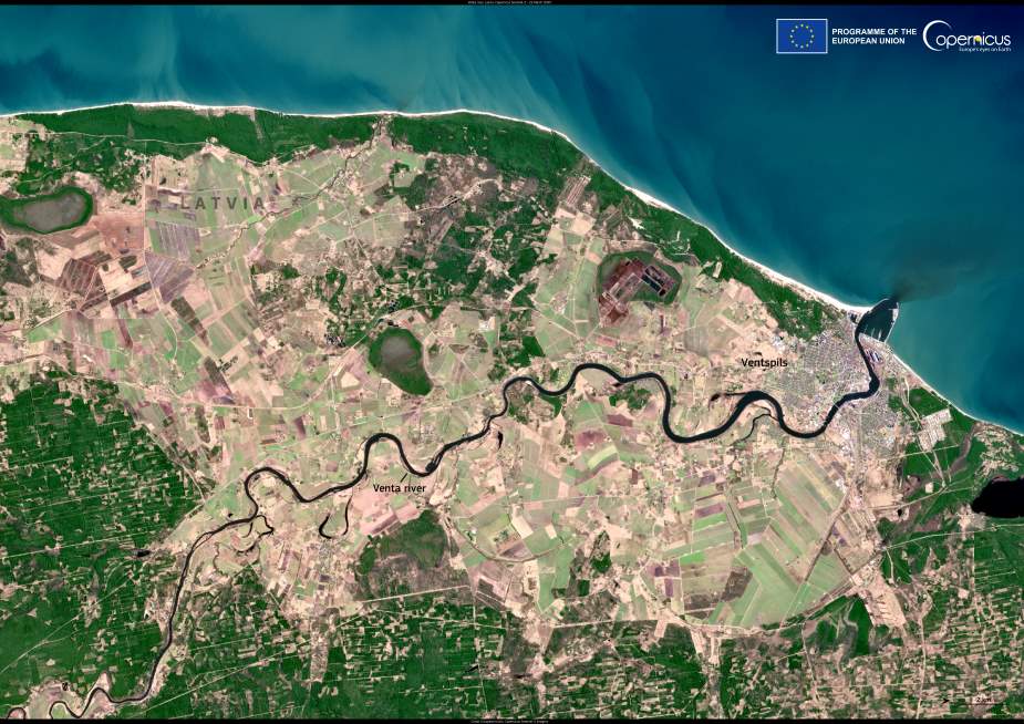
Seen from space, the Venta River traces a winding path across western Latvia before finally reaching the Baltic Sea at the port city of Ventspils. In this image captured by Copernicus Sentinel-2 on 22 March 2025, the river can be seen weaving through a landscape of forests and farmland as it completes its 346 km journey from its source in Lithuania.
The Venta has long been central to the region’s economy and ecology. It has served as a major trade and transport route and today supports biodiversity along its banks, including several nature reserves. Among its most striking natural features is the Venta hub (Ventas rumba) in the town of Kuldīga — a dolomite waterfall believed to be the widest in Europe. Measuring around 100 to 110 meters wide, and occasionally stretching to 249 meters during floods, the Venta hub becomes a seasonal stage for spawning fish attempting to leap upstream each spring and fall.

Geologically, the river cuts through layers of dolomite and reddish sandstone, forming rapids and calm sections that shape both the river’s flow and its rich surrounding habitats. The Venta is also dotted with islands, while its banks are largely forested, offering shelter to a range of plant and animal life.
The Copernicus Sentinel-2 satellite provides valuable data for monitoring rivers like the Venta, supporting sustainable water management and conservation efforts across Europe. Ventspils, where the river meets the sea, remains a vibrant hub shaped by this historic waterway, its past, present, and future closely tied to the Venta’s flow.
Featured image credit: European Union, Copernicus Sentinel-2 imagery


