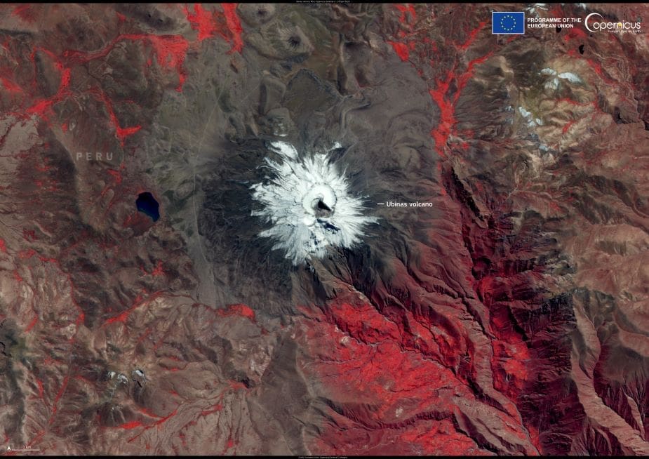
Ubinas Volcano in southern Peru is the country’s most active, rising to an elevation of around 5,672 metres in the Moquegua Region. Part of the Central Volcanic Zone of the Andes, Ubinas features a steep-walled summit crater more than a kilometre wide and has a long history of eruptions, with activity documented since the 1500s.
In recent years, Ubinas has shown frequent signs of unrest. Explosive activity has included ash emissions, gas plumes, and lahars — mudflows generated when volcanic material mixes with rain or melted snow. In early 2025, lahars descended through the Volcánmayo and Sacohaya drainages, prompting safety alerts and travel advisories from local authorities. Seismic monitoring continues to detect dozens of daily earthquakes linked to fluid movement and rock fracturing beneath the volcano.

Volcanic gas emissions, minor sulfur dioxide output, and elevated surface temperatures have also been recorded, indicating persistent shallow magmatic activity. The Peruvian Geophysical Institute (IGP) currently maintains a yellow alert level for Ubinas, advising people to remain at least two kilometres from the crater.
This image, acquired by one of the Copernicus Sentinel-2 satellites on 23 April 2025, shows the summit of Ubinas Volcano under clear skies, revealing the sharply defined crater and surrounding terrain.
The Copernicus Sentinel satellites provide crucial data on volcanic systems worldwide, supporting continuous monitoring and early warning systems that help reduce the risk to nearby communities.
Featured image credit: European Union, Copernicus Sentinel-2 imagery


