A major wildfire on the Greek island of Chios forced evacuations and emergency declarations after flames spread rapidly through forested areas on 22 June 2025. Villages in the path of the fire were evacuated as hundreds of firefighters battled to bring the blaze under control. The wildfire caused widespread disruption, knocking out power lines, cutting off water supplies, and damaging buildings and infrastructure across the island.
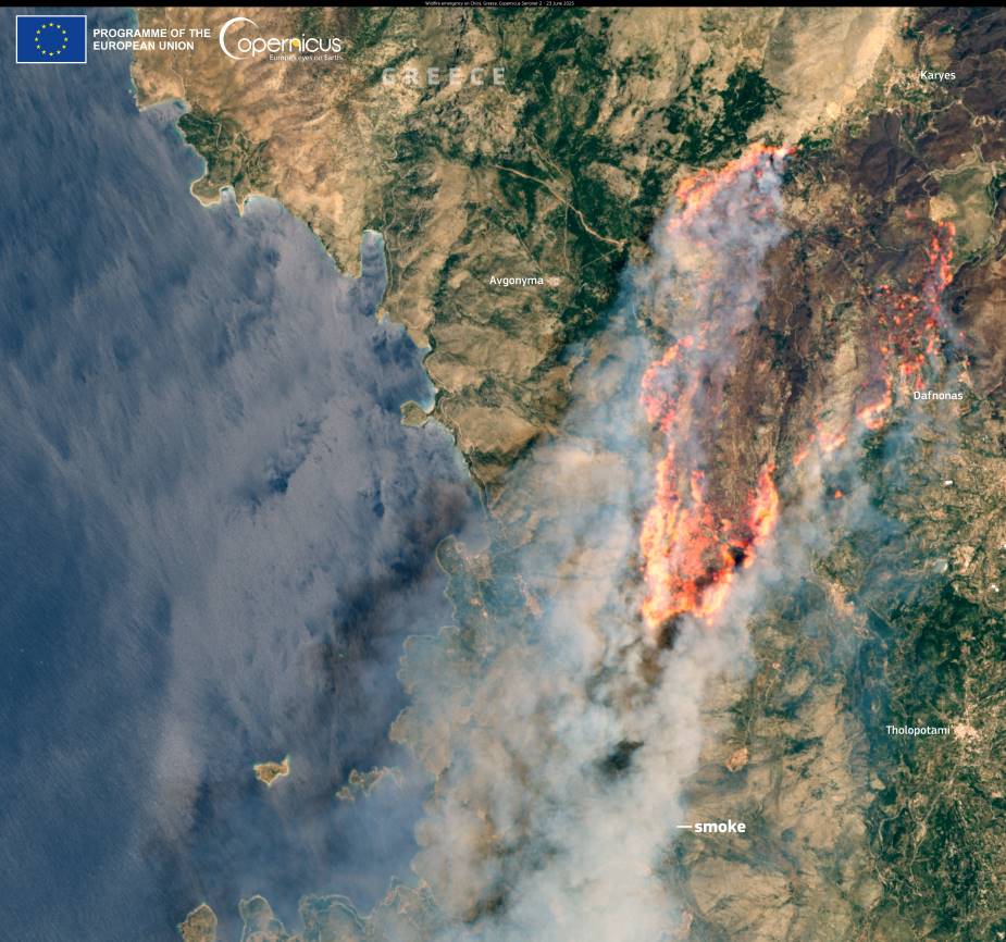
This image, captured by the Copernicus Sentinel-2 satellite on 23 June, shows thick smoke drifting southwest from Chios over the Aegean Sea, clearly marking the location and scale of the fire.

Authorities responded by declaring a state of emergency, with firefighting teams from across Greece and aerial support deployed to contain the fast-moving flames. The cause of the fire has not yet been officially confirmed, but unusually high temperatures and strong winds created conditions ripe for ignition and rapid spread.
Satellite data like this plays a vital role in wildfire monitoring. The Copernicus Sentinel programme provides open-access imagery that helps map active fire zones, assess burn scars, and track the movement of smoke. These tools are essential for managing evacuations, directing firefighting efforts, and evaluating the damage caused by such events.
Featured image credit: European Union, Copernicus Sentinel-2 imagery


