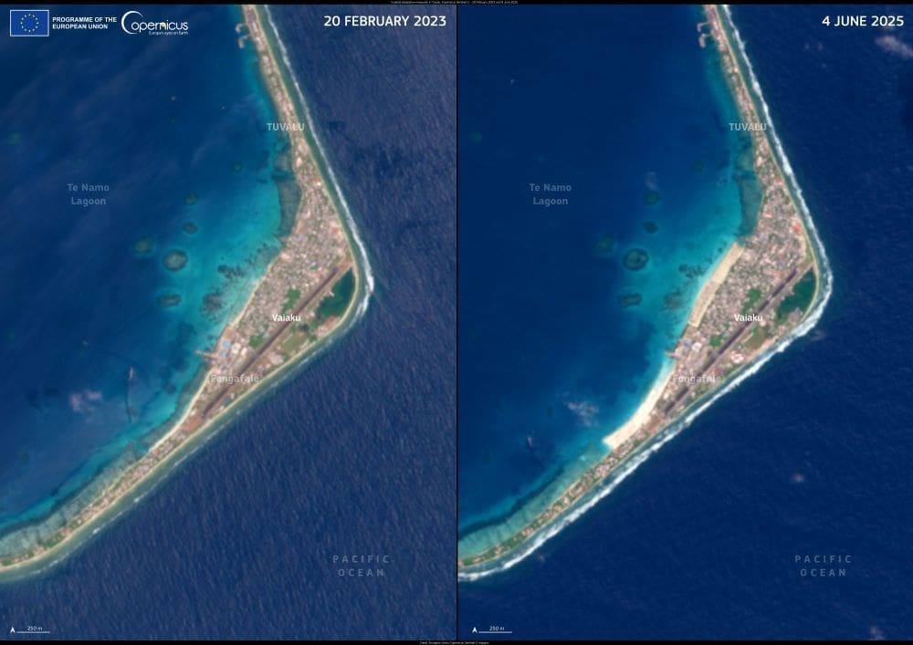
The Pacific island nation of Tuvalu is taking visible steps to adapt to the worsening threats of coastal erosion and sea-level rise. In this image, Copernicus Sentinel-2 satellite data captures two views of Funafuti –Tuvalu’s capital atoll – taken on 20 February 2023 and 4 June 2025. The changes on Fongafale, the atoll’s largest islet, reflect recent construction of new coastal buffers designed to limit flood damage and shoreline loss.
Tuvalu, made up of nine low-lying atolls and reef islands, ranks among the world’s most physically vulnerable countries to climate change. With much of its land barely two meters above sea level, even modest increases in ocean height pose serious risks to homes, freshwater resources, and public infrastructure. As part of its climate resilience efforts, Tuvalu has launched the Tuvalu Coastal Adaptation Project (TCAP), aimed at protecting its coastline through targeted engineering and nature-based solutions.

One of TCAP’s core interventions is the development of artificial and natural coastal buffers – structures that help absorb wave energy and limit erosion. On Fongafale, these include reinforced sea walls, breakwaters, and replanting of coastal vegetation. These defenses are essential for safeguarding critical areas, including the densely populated capital village.
Copernicus Sentinel-2 imagery plays a key role in monitoring these adaptations over time. The satellite’s high-resolution optical data allow researchers and policymakers to track changes in shoreline shape, evaluate project effectiveness, and plan future interventions based on up-to-date environmental data.
Funafuti is also recognized as an international geological heritage site for its atoll formation, further highlighting the importance of preserving its unique landscape in the face of mounting climate pressures.
Featured image credit: European Union, Copernicus Sentinel-2 imagery


