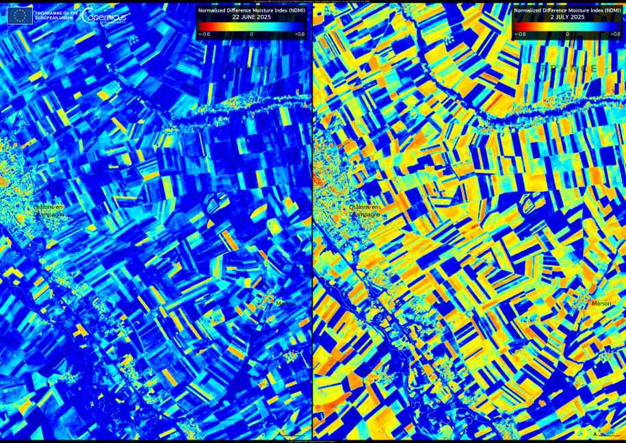
As Europe endures a severe heatwave with temperatures topping 40 °C across several countries, northern France is showing signs of growing drought stress. These satellite images, captured by Copernicus Sentinel-2 on 22 June and 2 July 2025, reveal how the agricultural areas around Châlons-en-Champagne have dried significantly in just ten days.
The images use the Normalised Difference Moisture Index (NDMI), a remote sensing measure of soil moisture. In late June, much of the landscape still showed blue tones, indicating healthy levels of moisture in the soil. By early July, these areas had diminished sharply, replaced by yellow and red patches that mark increasingly dry and stressed land.

This region of France, known for grain farming and vineyards, depends on consistent rainfall and stable soil conditions. The current heatwave, described by meteorologists as one of the most intense of recent years, has triggered health warnings and disrupted transport services across multiple European countries. For agriculture, the accelerating soil moisture loss raises concerns about crop failures and longer-term impacts on food production.
The Copernicus programme provides vital satellite data that helps scientists and decision-makers track how drought conditions develop. Changes like those seen in this NDMI sequence support early action to conserve water resources, protect harvests, and guide emergency responses.
Featured image credit: European Union, Copernicus Sentinel-2 imagery


