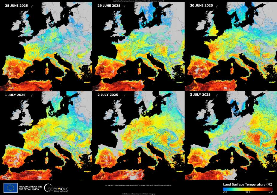
An intense heatwave has swept across Europe since late June 2025, with scorching land surface temperatures expanding eastward over the course of a week. The Copernicus Sentinel-3 satellite captured this dramatic evolution, showing how extreme heat first gripped the Iberian Peninsula before advancing through central and eastern Europe.
Derived from measurements by the Sea and Land Surface Temperature Radiometer (SLSTR), the visualisation reveals daily land surface temperature (LST) patterns from 28 June to 3 July. On 28 June, Spain and Portugal registered LST values above 50°C, highlighted in deep red on the map.

By 30 June, the heatwave had intensified over France, with surface temperatures nearing 49°C. In the following days, the heat spread further north and east, affecting Belgium, the Netherlands, and western Germany, with peaks around 45°C. On 3 July, the highest values were recorded across Poland, Hungary, Serbia, and Romania, again surpassing 50°C.
This image from the Copernicus Sentinel-3 mission illustrates how rapidly such events can escalate across the continent. While LST reflects the temperature of the land’s surface rather than the air, it provides critical insight into the severity and reach of heat episodes.
Copernicus data supports efforts to monitor vegetation stress, manage water resources, and issue public health guidance during extreme weather. Tools like SLSTR are essential in tracking how rising temperatures affect Europe’s landscapes and populations.
Featured image credit: European Union, Copernicus Sentinel-3 imagery


