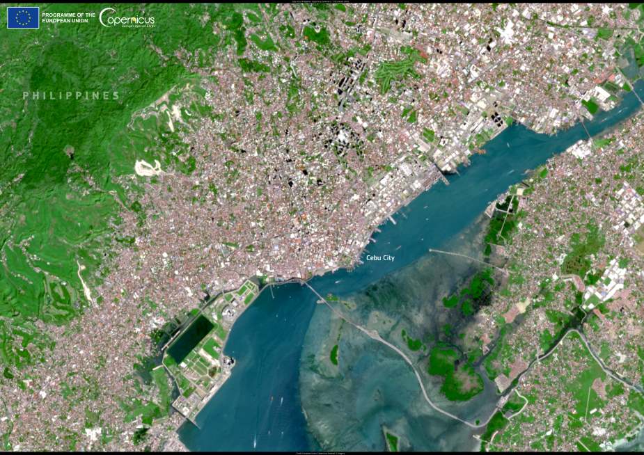
A striking satellite image captured on 18 January 2025 by one of the Copernicus Sentinel-2 satellites reveals the dynamic geography of Cebu City in the central Philippines. Positioned along the eastern coast of Cebu Island, the city stretches between steep interior hills and the narrow Cebu Strait, a busy maritime corridor that separates it from the island of Mactan.
Cebu City serves as a vital commercial and educational hub in the Visayas region. Its natural harbor, located at the heart of the central Philippine archipelago, has long anchored the city’s prominence in shipping, logistics, and regional trade. The urban core fans out from the waterfront, climbing into increasingly rugged terrain as it pushes inland – a pattern that reflects both the city’s constrained geography and ongoing expansion.

The satellite image, taken by Copernicus Sentinel-2, offers a high-resolution view of this complex landscape, combining coastal lowlands, river systems, and densely built-up zones. These earth observation satellites are operated under the European Union’s Copernicus Programme and are essential tools for environmental monitoring, urban planning, and disaster risk assessment.
In the Philippines, efforts to make Copernicus data more accessible and operational are supported by CopPhil, a project launched under the EU’s Global Gateway strategy. The initiative helps local authorities, scientists, and civil society apply satellite-derived data to improve hazard management, biodiversity conservation, and climate resilience. CopPhil exemplifies the broader aims of the Global Gateway in enhancing digital, energy, and climate partnerships with regions around the world.
Despite its economic importance, Cebu City faces multiple challenges tied to its geography – including exposure to typhoons, flooding, and urban congestion. Its location at the junction of marine and mountainous ecosystems makes it particularly sensitive to climate shifts and extreme weather. Copernicus imagery, updated regularly and freely available, supports data-driven decisions to navigate these risks while supporting sustainable development.
Featured image credit: European Union, Copernicus Sentinel-2 imagery


