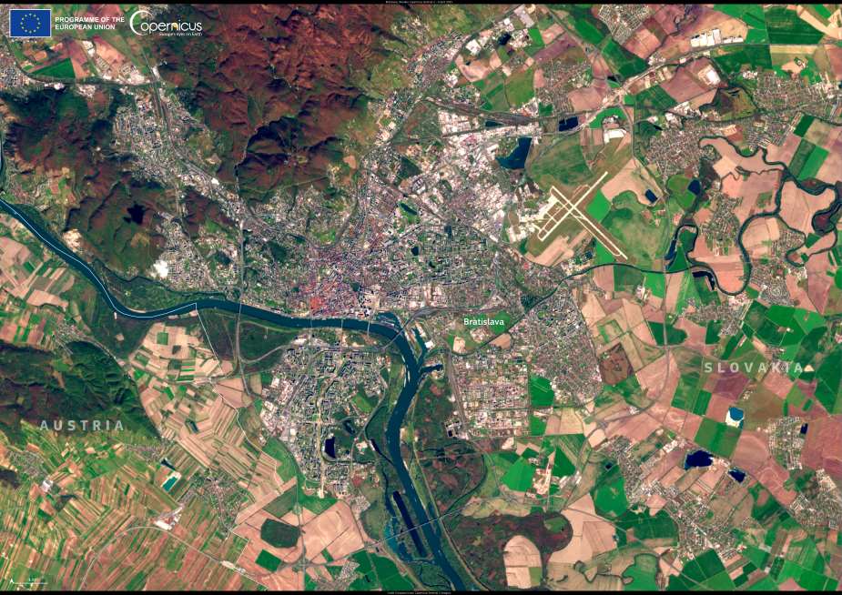
Bratislava, Slovakia’s capital, stretches along the Danube River and into the foothills of the Little Carpathians, creating a landscape where urban development meets protected natural areas. This strategic position has shaped the city’s role as a major political and cultural center in Central Europe, offering direct cross-border access to Austria, Hungary, and the Czech Republic.
The city’s distinctive geography is clearly visible in this image, captured by a Copernicus Sentinel-2 satellite on 4 April 2025. Bratislava is framed by the Danube on one side and forested hills on the other, with patches of floodplains, river branches, and alluvial forests integrated into its metropolitan area. Several of these zones form part of Natura 2000 protected sites, supporting biodiversity conservation while remaining close to the urban core.

With a history dating back over two millennia, Bratislava has been shaped by Celtic tribes, Roman military outposts such as Gerulata, and centuries of Hungarian rule – including a period as the coronation city for Habsburg monarchs. Reminders of this legacy remain prominent in the city’s architecture and traditions, including the annual Coronation Days procession that retraces the ceremonial route.
Today, Bratislava hosts top Slovak institutions, scientific and cultural organizations, and the European Labour Authority – the only EU agency based in Slovakia. Despite its status as one of Europe’s younger capital cities, it has emerged as a key player in regional cooperation and development across Central Europe.
The Copernicus Sentinel-2 mission continues to support cities like Bratislava by providing high-resolution data that tracks land use, monitors environmental conditions, and helps planners create greener, more sustainable urban spaces.
Featured image credit: European Union, Copernicus Sentinel-2 imagery


