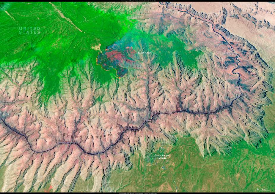
A destructive wildfire that swept through Grand Canyon National Park in Arizona earlier this month left a stark burn scar on the North Rim, now visible in satellite imagery. The blaze, ignited by lightning on 4 July, intensified on 11 and 12 July due to strong winds, forcing evacuations and destroying several park structures.
Among the damaged buildings were the historic Grand Canyon Lodge and the National Park Service visitor hub, both located on the North Rim. Hundreds of visitors were evacuated, and park operations in the affected area were temporarily suspended.

This image, captured by a Copernicus Sentinel-2 satellite on 15 July 2025, reveals the scorched landscape near the North Rim, where charred terrain contrasts sharply with the surrounding forested areas. Sentinel-2’s high-resolution optical sensors help document the full extent of wildfire damage and contribute to post-fire assessment and recovery planning.
Satellite data from the Copernicus programme plays a vital role in monitoring the scale and evolution of wildfires around the world. These observations support emergency services and authorities by providing timely information on fire progression, burn severity, and affected ecosystems.
Featured image credit: European Union, Copernicus Sentinel-2 imagery


