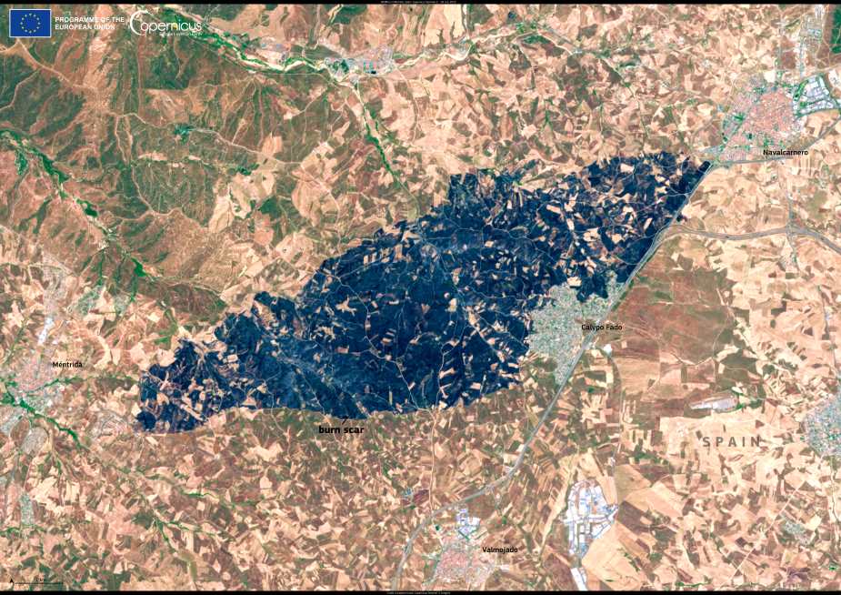
A fast-moving wildfire burned more than 3,000 hectares near the town of Méntrida in central Spain on 17 July 2025, sending thick smoke north toward Madrid. The fire broke out in the province of Toledo, in Castilla-La Mancha, and was rapidly intensified by strong winds that pushed flames through forest and scrubland. Roads were closed and residents in surrounding areas were evacuated as emergency crews tried to contain the fire.
By afternoon, winds had carried the smoke over the capital, turning the skies orange and filling the air with haze. Visibility dropped sharply as Madrid’s skyline disappeared behind layers of drifting smoke.

This image, taken by one of the Copernicus Sentinel-2 satellites on 18 July 2025, shows the blackened burn scar left behind around Méntrida. The dark areas in the photo reveal the extent of the damage across the landscape after just a few hours of intense fire.
The Copernicus Sentinel programme delivers crucial satellite data for monitoring wildfires around the world. The imagery helps map the affected areas and supports emergency teams and environmental agencies in assessing the scale of destruction.
Featured image credit: European Union, Copernicus Sentinel-2 imagery


