Nestled between Switzerland and Austria, the tiny principality of Liechtenstein stands out for its dramatic alpine scenery and deep historical roots. Covering just over 160 square kilometres, this landlocked nation offers a striking mix of rugged mountain terrain and a modern, high-income economy – all packed into one of the smallest countries in the world.
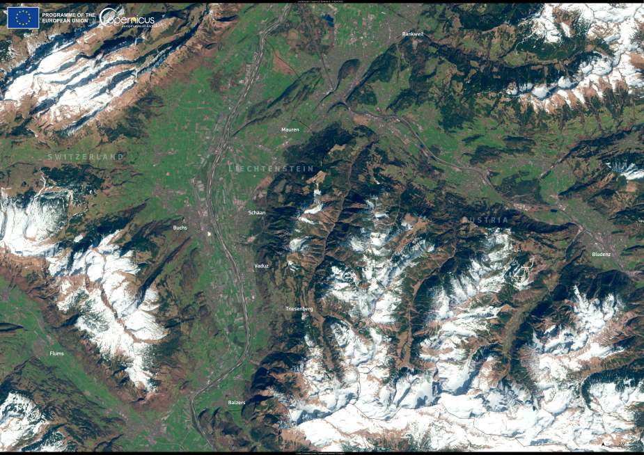
Liechtenstein’s mountainous terrain dominates the eastern part of the country, while the Rhine Valley stretches across the west. The country’s highest point, Vorder-Grauspitz, rises to 2,599 metres, in stark contrast to its lowest, the wetlands of Ruggeller Riet at just 430 metres above sea level. This sharp variation in elevation shapes a continental climate, with snow-laden winters and cool, humid summers – ideal conditions for both skiing and hiking, two pillars of Liechtenstein’s outdoor tourism economy.

This Copernicus Sentinel-2 image, captured on 7 April 2025, shows the principality in spring, when snow still lingers on the peaks while valleys begin to green. The open data provided by the Copernicus programme is particularly valuable in monitoring alpine environments like Liechtenstein, where careful planning is essential for both ecological protection and sustainable tourism.
Liechtenstein’s history is marked by centuries of adaptation. Originally part of the Holy Roman Empire, the principality became sovereign in 1806 and fully independent in 1866. After World War I, economic hardship led it to forge a customs and monetary union with Switzerland – a relationship that continues today. While Liechtenstein once faced international criticism for weak financial regulation, it has since strengthened its laws and enforcement to meet international standards.
Despite its size, Liechtenstein has leveraged its natural beauty and strategic partnerships to become a model of stability and economic resilience – a place where alpine charm meets a quietly industrious spirit.
Featured image credit: European Union, Copernicus Sentinel-2 imagery


