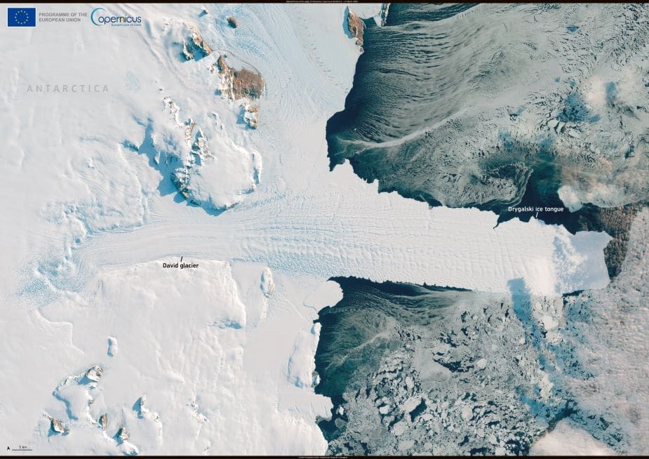
In this Sentinel-2 image from 17 March 2025, Antarctica’s David Glacier is seen feeding the Drygalski Ice Tongue – a long, blade-like structure slicing nearly 90 kilometers into the Ross Sea. The scene captures the force of a glacier in motion, driving ice seaward in a slow but relentless flow.
Located on the Scott Coast of Victoria Land, the Drygalski Ice Tongue is one of the largest floating ice extensions in East Antarctica. It forms where the grounded David Glacier pushes outward into the ocean, creating a semi-permanent tongue of ice that juts far beyond the coastline. From orbit, the structure appears as a stark, pale projection surrounded by fractured sea ice and dark polar water.

These ice tongues behave like natural laboratories, offering a window into glacial mechanics and ocean–ice interactions. Though relatively stable, the Drygalski Ice Tongue is subject to continuous change. Calving events, tidal stresses, and wave action gradually reshape its edges, while seasonal and long-term climate shifts influence the glacier feeding it.
The Copernicus programme plays a key role in tracking these dynamics. Using satellites like Sentinel-2, scientists can monitor ice flow, detect surface cracks, and estimate loss rates in remote polar regions. This data feeds into global models of sea-level rise, helping researchers project future scenarios under warming conditions.
Drygalski was first mapped during early 20th-century Antarctic expeditions, but today its evolution is followed with precision from space – a reminder of how satellite technology is transforming polar science.
Featured image credit: European Union, Copernicus Sentinel-2 imagery


