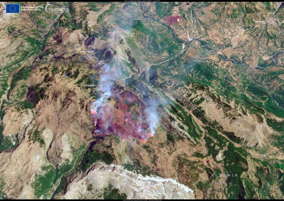
A series of wildfires swept across Albania in mid-July 2025, prompting emergency alerts and mobilization of national firefighting resources. According to the Albanian Ministry of Defence, 18 separate blazes were reported within a 24-hour period, affecting multiple municipalities and threatening both residential communities and protected natural areas.
Among the hardest-hit locations was Lura National Park in Dibër municipality, a remote and ecologically sensitive area in the country’s northeast. Flames reached forested zones near the park’s iconic “Lake of Flowers”, raising concerns over damage to native biodiversity and habitat loss.

This Copernicus Sentinel-2 image, captured on 21 July 2025, shows an active wildfire burning within Lura National Park. Smoke is visible rising over the mountainous terrain, offering a stark view of the fire’s scale and intensity.
The situation has triggered increased emergency measures as authorities work to contain the fires and limit further destruction. Officials have also warned of continued risks as high temperatures and dry conditions persist throughout the region.
Satellite data from the Copernicus Sentinel missions plays a crucial role in real-time monitoring of wildfires across Europe and beyond. The imagery supports emergency response teams by mapping fire progression and providing assessments of burned areas and their environmental impacts.
Featured image credit: European Union, Copernicus Sentinel-2 imagery


