Portugal is battling a series of major wildfires that broke out across the north and centre of the country in late July, driven by scorching heat and prolonged drought. As of 29 July, more than 2,000 firefighters have been deployed to contain three large fires in Arouca (Aveiro District), Ponte da Barca (Viana do Castelo District), and Penamacor (Castelo Branco District). These fires have triggered evacuations and raised alarms about the escalating impact of extreme weather on rural communities.
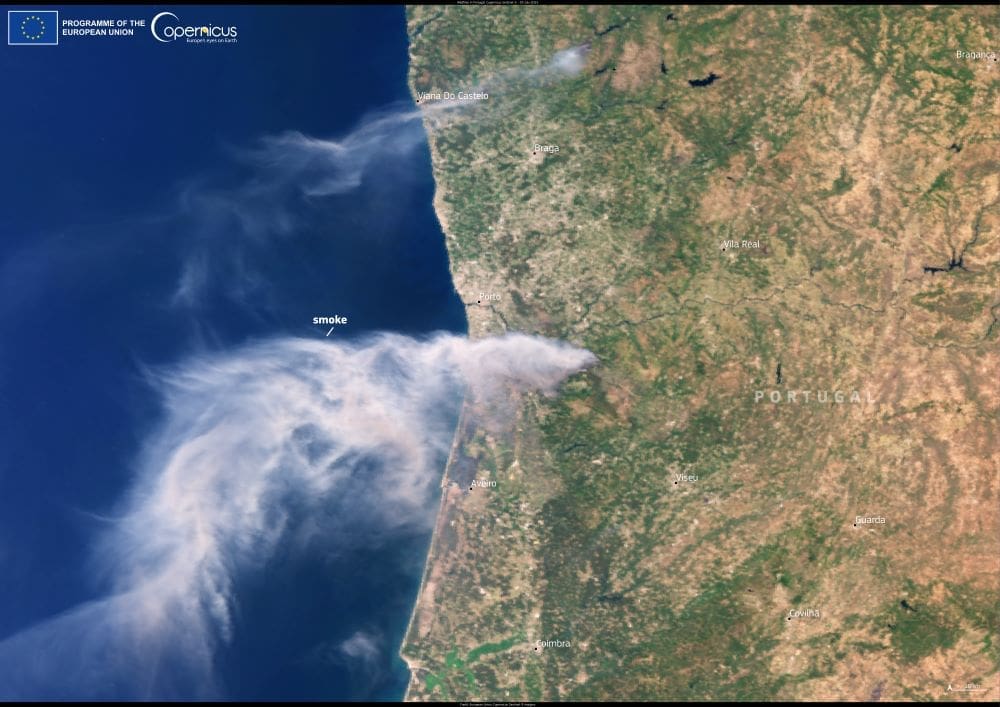
This image, taken by one of the Copernicus Sentinel-3 satellites on 29 July 2025, shows two prominent smoke plumes drifting across northern Portugal. The largest is rising from the wildfire burning in the hills near Arouca, where flames have swept through forested areas and forced the overnight evacuation of the village of Fornos de Carvão. A second, smaller plume is visible further north, marking the ongoing fire near Ponte da Barca.

The affected regions are characterised by steep terrain and dense vegetation, conditions that make firefighting efforts particularly challenging. High temperatures and shifting winds have added to the complexity of the response, with civil protection authorities issuing red alerts for several districts at risk.
The Sentinel-3 image underscores the scale of the crisis and the importance of satellite-based monitoring in wildfire management. The Copernicus programme provides critical data for early detection, fire behaviour modelling, and post-event damage assessment. By delivering near real-time imagery, these satellites help emergency services allocate resources, evaluate risk, and coordinate large-scale operations.
Featured image credit: European Union, Copernicus Sentinel-3 imagery


