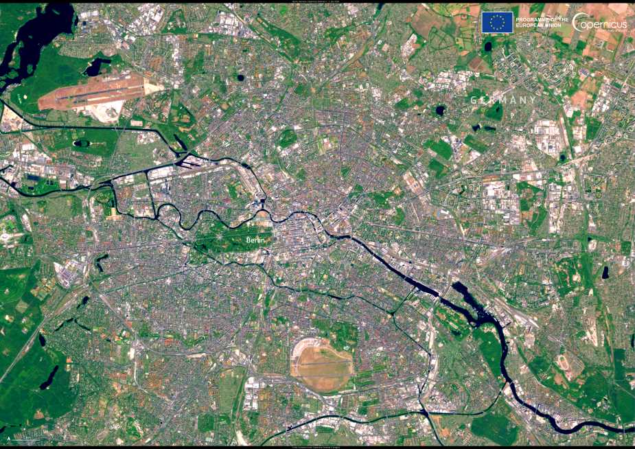
From the air, Berlin appears as a vast mosaic of stone, water, and green – a landscape shaped by centuries of conflict, division, and reinvention. This Copernicus Sentinel-2 image, captured on 1 July 2025, offers a clear view of Germany’s capital, revealing both the scale of the city and the natural features woven into its urban fabric.
Stretching over roughly 890 square kilometres, Berlin ranks among Europe’s largest cities by area. Despite its size, the city maintains a striking balance between infrastructure and nature. Dense residential and industrial zones are interspersed with forests such as Grunewald and expansive green spaces like the Tiergarten, visible here as deep green patches contrasting the grey cityscape. The Spree River meanders through the centre, echoing the historical spine of a city long shaped by its geography.

Berlin’s evolution from the capital of the German Reich to a divided Cold War outpost, and finally to the seat of a reunified Germany, is embedded in its layout. The former divide between East and West Berlin still manifests in architectural and spatial patterns that satellite images subtly reflect. Landmarks like the Brandenburg Gate and the remnants of the Berlin Wall stand not far from modern government buildings and cultural institutions, anchoring the present in a complex past.
Today, Berlin is home to 3.57 million people and a hub for tourism, tech, and culture. Its boroughs are rich with diversity, including Germany’s largest Turkish community, and offer a snapshot of how the city continues to redefine itself.
Copernicus open data supports urban planning, land use monitoring, and environmental management, offering vital insight for Berlin’s sustainable development and for other cities navigating the pressures of growth and climate adaptation.
Featured image credit: European Union, Copernicus Sentinel-2 imagery


