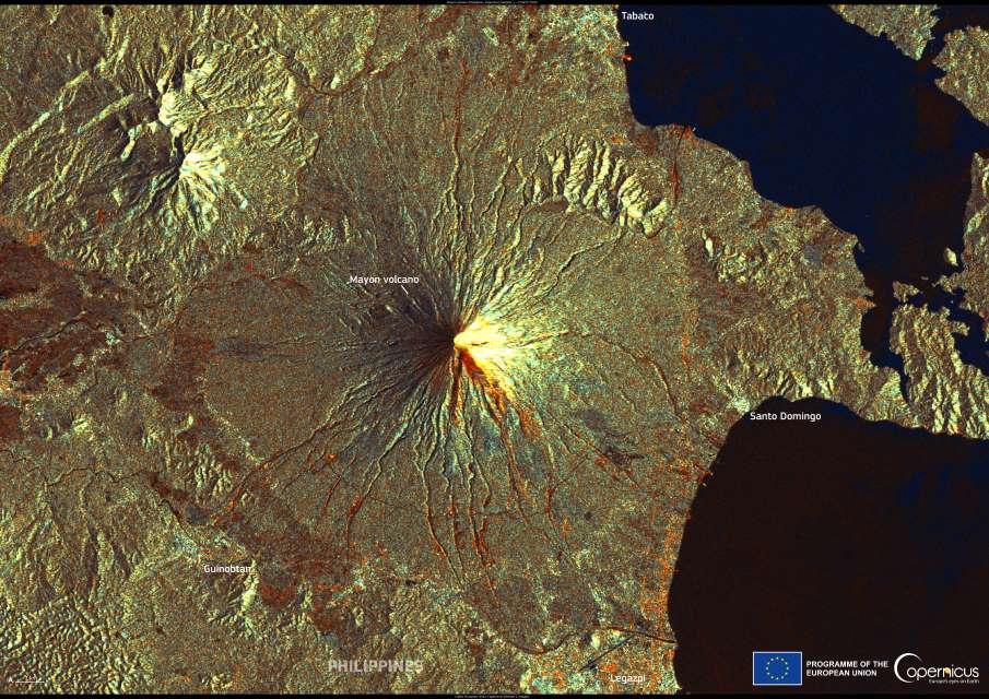
Mayon Volcano, in the Albay province of the Philippines, rises 2,462 metres above sea level and is famed for its near-perfect conical shape. Located on southeastern Luzon Island and dominating the city of Legazpi, it is part of the Pacific Ring of Fire and a protected area under the Philippine National Integrated Protected Areas System. Its fertile slopes support diverse ecosystems and extensive abaca plantations, but the volcano’s frequent activity has made it one of the most closely monitored in the country.
The volcano’s base stretches 130 kilometres in circumference, and it sits at the centre of Mayon Volcano National Park, covering 55 square kilometres. Since its first recorded eruption in 1616, Mayon has erupted more than 30 times. Notable events include the 1814 eruption that buried the town of Cagsawa and killed around 1,200 people, and a 1993 eruption that caused 79 fatalities. More recent activity in 2000, 2006, 2009, 2014, and 2018 forced tens of thousands to evacuate. In 2006, rains from Typhoon Durian triggered mudslides and floods that killed more than 1,000 people at the volcano’s base.

One of the Copernicus Sentinel-1 satellites captured this radar image on 2 March 2025, showing the volcano’s radial drainage patterns and lava channels in remarkable detail. These observations are part of a global monitoring effort, with Sentinel satellites providing open-access data used for eruption detection, hazard mapping, and early warning systems aimed at protecting communities at risk.
Mayon remains a popular destination for climbers and campers, drawing visitors with its striking profile and surrounding landscapes – even as it continues to remind residents and scientists alike of the power and unpredictability of active volcanoes.
Featured image credit: European Union, Copernicus Sentinel-1 imagery


