Uluru in Australia’s Northern Territory rises 348 metres above the desert plain and has stood for more than 500 million years. Known to the Anangu people as Uluṟu, the name is from the Pitjantjatjara language and has been in use long before European arrival.
European exploration again reshaped its identity in 1873, when William Gosse – becoming the first non-Aboriginal person to behold the rock – named it Ayers Rock in honour of Sir Henry Ayers, Chief Secretary of South Australia. Up until 1993, Ayers Rock remained widely used. That year, it officially adopted the dual name Ayers Rock / Uluṟu, which was later reordered in 2002 to Uluṟu / Ayers Rock, the official nomenclature still used today – and within the national park, the traditional name Uluṟu is always preferred.
The rock and its surrounding area form Uluṟu-Kata Tjuṯa National Park, inscribed on the UNESCO World Heritage List for both natural and cultural values. In 1987, it gained recognition as a natural heritage site showcasing ongoing geological, biological, and ecological processes, as well as ‘natural beauty with an exceptional combination of natural and cultural elements‘. In 1994, it became the second national park in the world to be inscribed as a cultural landscape, highlighting its deep significance to the Anangu people.

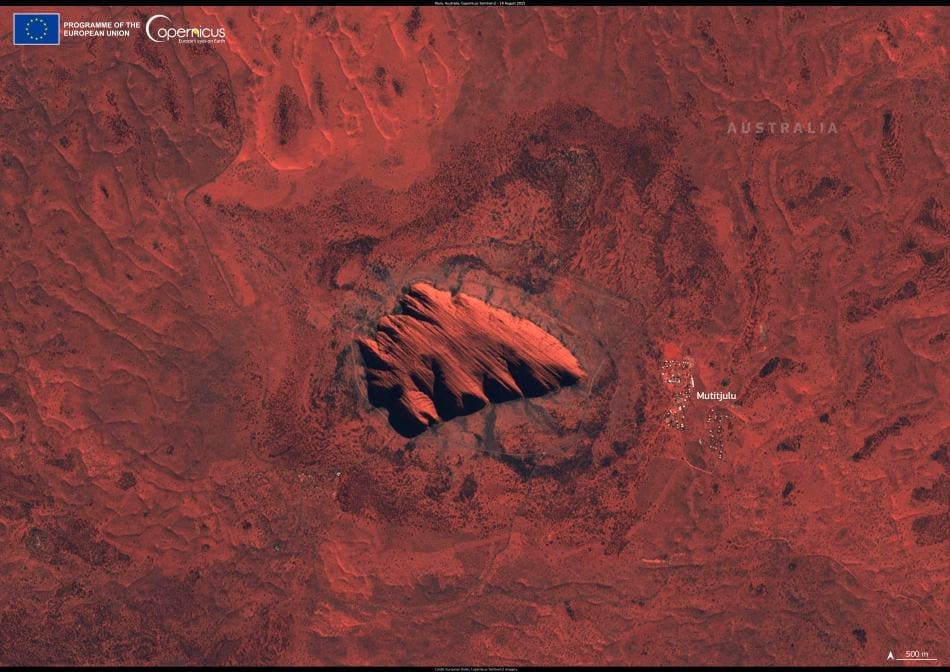
This Copernicus Sentinel-2 image, acquired on 14 August 2025, shows Uluṟu from above, with the Mutitjulu Aboriginal community visible to the east. Sentinel satellites monitor ecologically and culturally significant sites globally, offering invaluable data to track environmental change and reinforce protection of these treasured areas.
Visitors today can experience Uluṟu’s grandeur and its profound cultural heritage in person. The park’s dual World Heritage listings help sustain tourism in Central Australia, delivering essential economic benefits while ensuring management in harmony with ancient cultural practices. The Anangu people remain central to this stewardship, applying traditional knowledge such as fire management, water conservation, and sustainable visitation to preserve both the landscape and its living stories.
Copernicus Sentinel-2’s frequent, high-resolution multispectral imagery – collected by twin polar-orbiting satellites with a 290 km swath and a revisit time of about five days – supports vegetation monitoring, land use mapping, and ecological assessment. Beyond producing striking views like this one, the mission provides crucial insights for managing and conserving Uluṟu, ensuring this sacred and natural landmark endures for generations to come.
Featured image credit: European Union, Copernicus Sentinel-2 imagery


