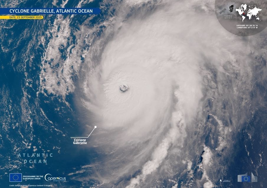
Cyclone Gabrielle developed in the central Atlantic Ocean in mid-September 2025 and rapidly strengthened as it moved eastward. By 22 September, it had intensified into a Category 4 hurricane with sustained winds reaching around 220 km/h (137 mph), making it the second major storm of the 2025 Atlantic season.
The Copernicus Sentinel-3 satellites captured this image on 23 September 2025, showing Cyclone Gabrielle swirling over the Atlantic Ocean as it tracked toward the Azores. Satellite data such as this play a key role in monitoring the evolution of severe storms, providing essential information on their movement, wind structure, and potential impacts.

Gabrielle reached the Azores on 26 September as a post-tropical cyclone, bringing heavy rain, powerful winds, and large waves across much of the archipelago. Although the system had weakened, it still caused widespread disruption, with power outages, fallen trees, and damage to buildings reported on several islands. The Azores’ regional authorities had placed the islands under red alert, suspending public services and coastal activities until the storm passed.
Wind gusts reached up to 154 km/h (96 mph) at ground level, well below the 200 km/h (125 mph) predicted earlier by forecasters, and sea swells peaked below the expected 18 meters. Conditions gradually improved as Gabrielle moved eastward toward mainland Portugal over the weekend.
Featured image credit: European Union, Copernicus Sentinel-3 imagery


