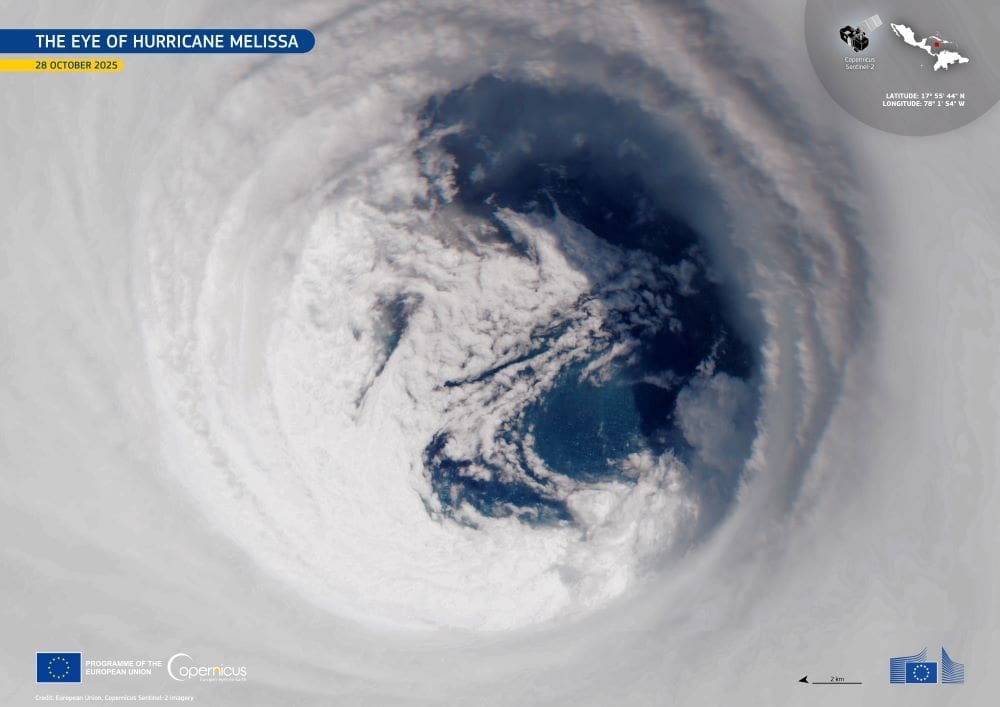
The Copernicus Sentinel-2 mission captured a striking image of Hurricane Melissa on 28 October 2025, showing the storm’s eye with exceptional clarity as it approached Jamaica’s southern coast. Recorded at 15:55 UTC, the satellite view reveals the precise symmetry of one of the Atlantic basin’s most intense hurricanes on record, with sustained winds measured at 298 km/h and a central pressure of 892 hPa.
In the image, the hurricane’s eye appears as a near-perfect circle, surrounded by thick, bright cloud walls that define its eyewall – the zone of strongest winds and heaviest convection. From this centre, spiralling bands of clouds radiate outward in tightly coiled arcs, tracing the storm’s vast rotational structure across the Caribbean Sea. The high-resolution optical sensors of Sentinel-2 capture the sharp boundaries between these swirling formations and the surrounding ocean, creating a vivid contrast between calm and chaos.

Just north of the storm’s core lies Jamaica, visible as a small landmass on the edge of the satellite frame. The positioning of the island relative to the hurricane’s eye offers a rare spatial perspective, illustrating both the immense scale of the storm and the precision of modern Earth-observation technology.
The Sentinel-2 mission, part of the European Union’s Copernicus Programme, provides detailed optical imagery used for environmental monitoring and crisis response. During extreme weather events, its high-resolution data assist authorities in rapid mapping and situational awareness, supporting coordination between emergency services and relief operations.
By capturing the distinct geometry of Melissa’s eye hours before landfall, Sentinel-2 delivered not only a visually arresting image but also critical observational data. The picture encapsulates the power and organisation of a mature tropical cyclone – the sharply defined calm at its centre ringed by towering convective clouds, each structure recorded with metre-scale precision from orbit.
Through images like this, Copernicus missions continue to document the dynamics of the planet’s most powerful natural systems, offering both scientific insight and operational value when it matters most.
Featured image credit: European Union, Copernicus Sentinel-2 imagery


