The Copernicus Sentinel-6 mission provides the world’s most accurate measurements of sea surface height, helping scientists monitor rising sea levels and better understand how the oceans respond to climate change. The first satellite in the mission, Copernicus Sentinel-6 Michael Freilich (Sentinel-6A), was launched in 2020 and continues to deliver high-precision data essential for both climate research and operational oceanography.
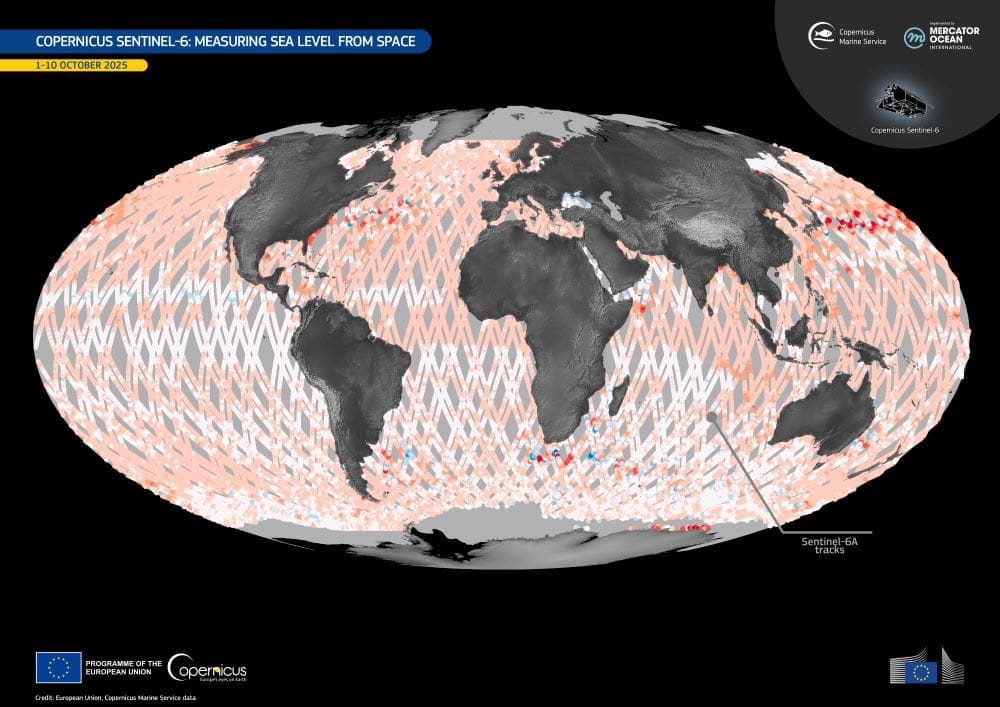
Sentinel-6A follows a 10-day repeat orbit, capturing detailed observations of sea surface height with centimetre-level accuracy. These measurements form a global reference for monitoring ocean levels and contribute to a long-term record that extends more than three decades of satellite altimetry data.

The image above, provided by the Copernicus Marine Service, visualises sea surface height observations collected by Sentinel-6A along its orbit between 1 and 10 October 2025. Integrated with data from other Copernicus Sentinel satellites and partner missions, this information supports public authorities, researchers, and industry in managing ocean resources and assessing the impacts of climate change on marine systems.
To ensure continuity of these vital records, the second satellite in the series – Copernicus Sentinel-6B – is scheduled for launch in November 2025. With a nominal lifetime of about five and a half years, Sentinel-6B will maintain the stability and accuracy of global sea level monitoring through 2030. Together, the twin satellites form a cornerstone of Europe’s long-term ocean-monitoring programme, building on the legacy of earlier missions such as Jason-3.
For more information, visit the Copernicus website.
Featured image credit: European Union, Copernicus Marine Service Data


