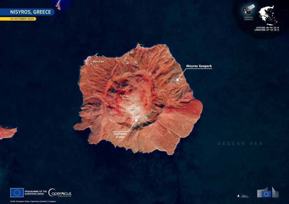
Nisyros island’s volcanic landscape is at the core of this Image of the day, bringing together the island’s geological character and its recent recognition as a UNESCO Global Geopark. The new status, awarded in September 2025, reflects the island’s position within one of the most tectonically active zones of the eastern Mediterranean, where past eruptions, caldera formation, and ongoing hydrothermal activity continue to shape the terrain.
Nisyros island’s volcanic landscape dominates the scene in this false-colour Copernicus Sentinel-2 image from 10 October 2025. Vegetation appears in red, while grey and brown tones mark bare surfaces and lava fields. Near the centre lies the Stefanos Crater, measuring 330 m across and 27 m deep. The Nisyros Geopark spans the entire island along with the nearby islets of Pergousa, Pachia, Kondeliousa, and Strongyli, forming a unified natural system shaped by volcanic and submarine processes over thousands of years.

The path toward UNESCO designation began with an application submitted in November 2021 and supplemented in early 2025 for final evaluation. Local authorities describe the achievement as a turning point for the island’s future. In a related announcement, Mayor Christofis Koroneos said that “this international recognition represents a landmark moment for our island, highlighting not only the unique natural and cultural wealth of Nisyros, but also the significance of the surrounding islets of Pergousa, Pachia, Kondeliousa, and Strongyli, as well as the marine area between them, which form an integral part of the Geopark. Together they compose a rare geological mosaic, unique in the world, opening the way for further protection and promotion of the site.”
He noted that “this is an opportunity to ensure that the natural beauty and geological heritage of our island will remain intact, while at the same time creating sustainable development prospects for the local community. It is also a great responsibility, as it confirms the need to implement strict and comprehensive strategies for the conservation and protection of Nisyros’ natural environment, geological formations, and cultural heritage.”
“The protection of these natural resources is of vital importance, not only for the preservation of natural heritage but also for securing a sustainable future for coming generations,” Koroneos added.
Copernicus data supports this work by helping track volcanic activity and informing strategies to safeguard significant geological and cultural sites.
Featured image credit: European Union, Copernicus Sentinel-2 imagery


