Saharan dust drifting over Sardinia and Corsica is a familiar seasonal phenomenon in the western Mediterranean, yet each episode offers a clear view of how airborne particles travel across long distances. In mid-November, air masses moving north from North Africa carried a broad dust plume toward Europe, creating hazy skies and affecting visibility across the region.
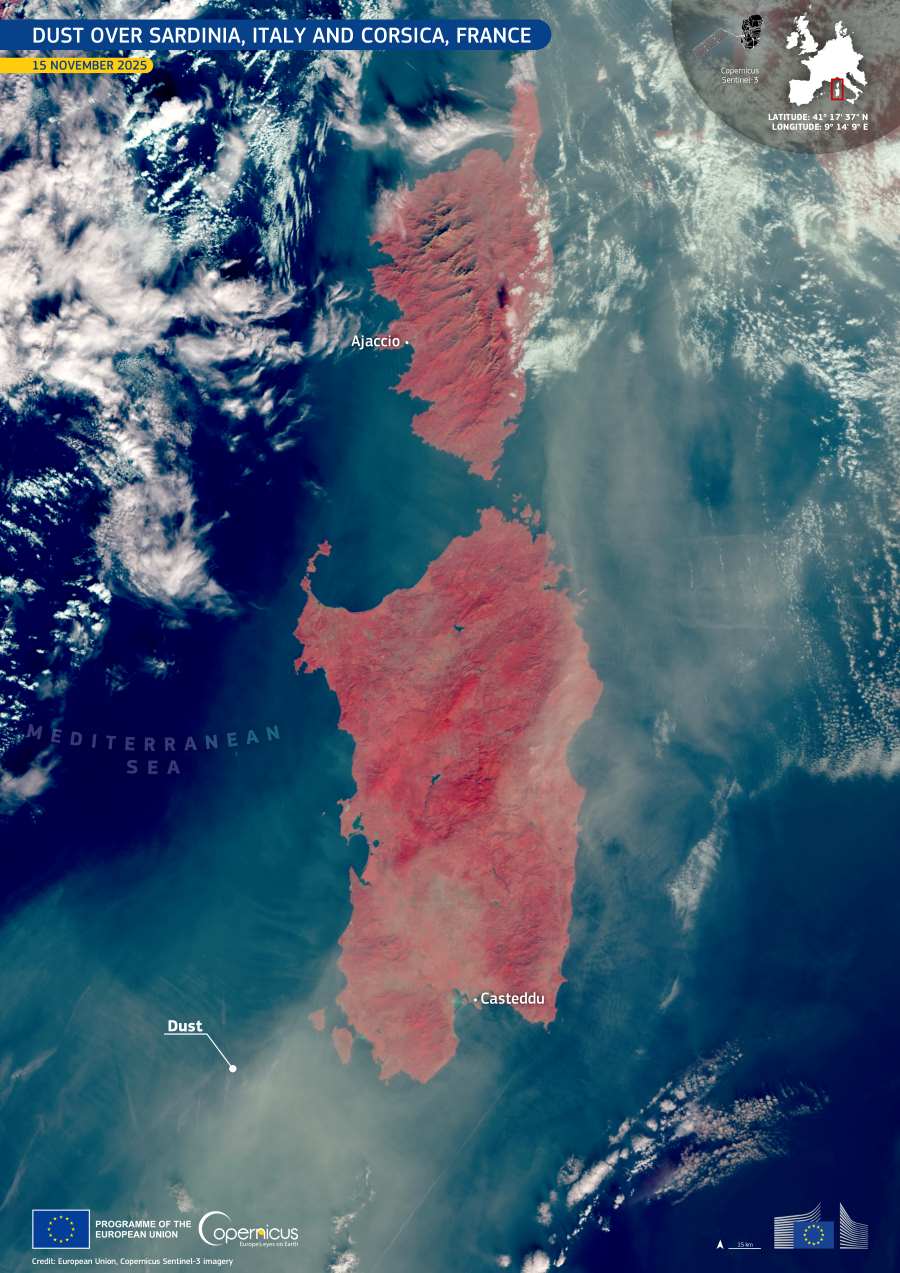
On 14 November, a dust storm developed over parts of North Africa and advanced across the Mediterranean basin. By the following day, the plume had reached both Sardinia and Corsica, spreading a diffuse veil over the islands and nearby waters. In the middle of this event, this Copernicus Sentinel-3 image, acquired on 15 November, captures a thick layer of Saharan dust stretching northwards and partially covering the two islands, with the suspended material especially visible along their eastern coasts.

The false-colour representation reveals reddish tones over land, commonly used to distinguish vegetation and bare soils in near-infrared composites. In contrast, the pale, milky layer drifting over the Tyrrhenian Sea marks the presence of airborne mineral dust. The pattern forms a continuous band tracing the path of the plume from the African coastline toward southern Europe, illustrating how easily particles can be transported across large bodies of water.
Scientists use data from the Copernicus Sentinel missions to monitor dust movement, analyse particle density, and understand how these events influence air quality. Such observations support early-warning systems for communities regularly exposed to Saharan dust, helping regional authorities anticipate periods of reduced visibility and potential impacts on public health.
Featured image credit: European Union, Copernicus Sentinel-3 imagery