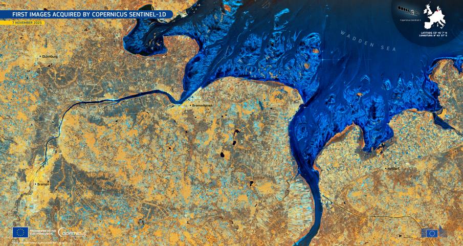
Northern Germany appears in a detailed radar view captured soon after the launch of Copernicus Sentinel-1D, offering a clear look at the region’s landscape. The image, acquired on 7 November 2025, shows a mix of agricultural land, coastal environments, and several major urban centres, including Bremen, Bremerhaven, Oldenburg, and Meldorf. The Elbe and Weser rivers trace broad paths toward the North Sea, forming dark, branching features across the scene.
Sentinel-1D is the newest spacecraft in Europe’s radar mission, designed to provide continuous monitoring regardless of weather or daylight. Its early data add resilience to the wider Copernicus system by ensuring more consistent coverage for users who depend on regular radar observations. Subtle variations in northern Germany’s land use are captured with strong clarity, revealing differences between cultivated parcels, waterways, and built-up areas.

The radar view uses a false colour presentation to enhance contrasts between surface types, with the rivers and coastal waters standing out in deep blue tones. The Wadden Sea forms a distinctive pattern at the edge of the North Sea, while urban areas appear in brighter shades that reflect their dense structures. The combination of these features gives a clear impression of how the region’s natural and human-made elements interact across the landscape.
As the satellite becomes part of routine operations, its data will support Copernicus Services involved in emergency response, marine monitoring, and land applications. An EU Space Observer note explains that the mission will strengthen the constellation and contribute to the EU’s strategic autonomy in Earth observation by improving reliability and continuity in radar coverage.
Featured image credit: European Union, Copernicus Sentinel-1 imagery


