Storm Leonardo reshaped weather patterns across southern Spain and the western Mediterranean in early February 2026, leaving flooding on land and hazardous conditions at sea. As the system moved across the Iberian Peninsula and parts of North Africa on 3 February, intense rainfall hit large areas of Andalusia, where some locations recorded between 200 and 400 mm within 24 hours. Rivers rose rapidly, drainage systems were overwhelmed, and emergency services were placed on high alert.
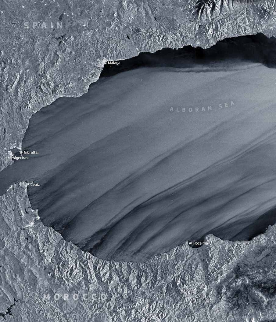
Off the southern coast of Spain, the storm’s energy transferred directly into the Alboran Sea. Strong, sustained winds drove heavy seas and sharply reduced operational safety for vessels navigating the region. Maritime authorities responded by suspending port operations at Gibraltar and Algeciras, two critical hubs for shipping, bunkering, and transit through the Strait of Gibraltar. The closures reflected the severity of the sea state rather than isolated port conditions, as wind and wave activity affected the entire passage between the Atlantic Ocean and the Mediterranean Sea.

This Copernicus Sentinel-1 radar image, acquired on 4 February 2026 at 06:18 UTC, captures the storm’s imprint on the sea surface. Long, linear streaks stretch across the Alboran Sea, aligned with the prevailing wind direction. These patterns form as variations in surface roughness reflect changes in wind speed and turbulence, offering a visual record of the storm’s intensity even through cloud cover and darkness.
The Strait of Gibraltar sits at the centre of this scene. As one of the world’s busiest maritime corridors, it concentrates commercial shipping, ferries, and fuel supply operations within a narrow channel bordered by Spain and Morocco. When severe weather disrupts this corridor, delays and diversions can ripple far beyond the region, affecting vessel schedules across the Mediterranean and Atlantic basins.
Satellite observations from Copernicus Sentinel-1 play a key role during such events. By monitoring wind fields, wave patterns, and evolving sea conditions, the data support maritime safety decisions, port management measures, and emergency planning when storms like Leonardo push coastal and offshore systems to their limits.
Featured image credit: European Union, Copernicus Sentinel-1 imagery