Rising over 3,300 meters on the eastern coast of Sicily, Mount Etna is Europe’s most active volcano and one of the most studied in the world. Its eruptive history spans hundreds of thousands of years, with near-continuous activity shaping both the landscape and scientific understanding of volcanology. The volcano also supports unique ecosystems, hosting endemic plant and animal species adapted to its dynamic environment.
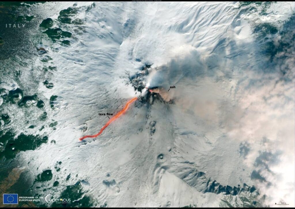
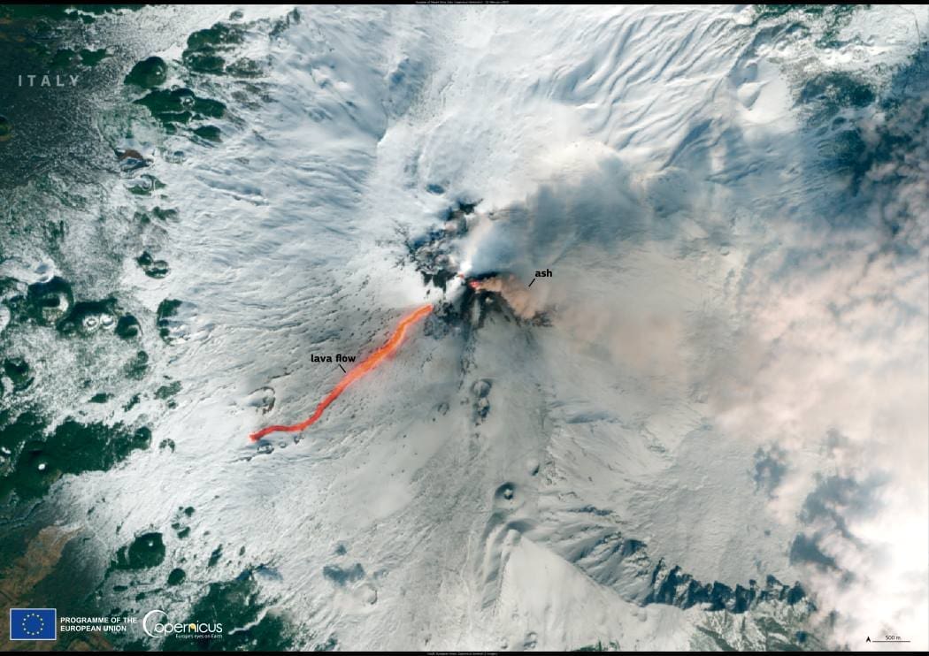
On 8 February 2025, Mount Etna entered a new eruptive phase, sending lava flows and ash plumes across its slopes. The eruption produced a lava flow extending approximately three kilometers, while ash emissions temporarily disrupted operations at Catania Airport. Despite this, flights have largely continued under close monitoring. Scientists remain on alert as Etna’s latest activity unfolds, analyzing its behavior to anticipate potential hazards.

This image, captured by the Copernicus Sentinel-2 satellite on 12 February 2025, reveals the fiery descent of molten rock from the volcano’s slopes. The bright lava flows stand out against the darker volcanic terrain, offering a striking visual of Etna’s ongoing activity.
The Copernicus Sentinel satellites play a crucial role in monitoring volcanic activity worldwide, providing real-time data that aids researchers and authorities in assessing risks. By tracking changes in Etna’s eruptions, these observations help improve understanding of volcanic processes and inform safety measures for local communities.
Featured image credit: European Union, Copernicus Sentinel-2 imagery


