After a powerful storm swept across the Greek island of Paros in late March 2025, the scale of its impact became evident both on land and at sea. Streets in Parikia and Naousa were overwhelmed by torrential rain and hail, turning into rivers that carried debris and vehicles through town centers. Although the flooding caused widespread disruption, emergency teams managed to rescue 13 people trapped by rising waters, with no injuries or missing persons reported.

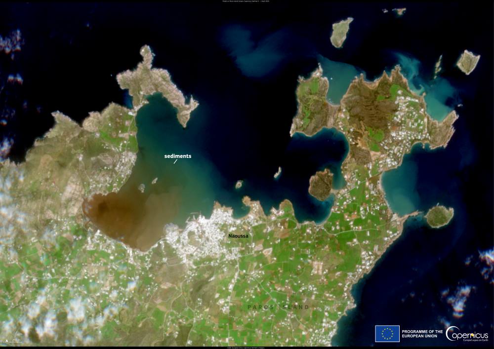
Captured on 1 April 2025, this Copernicus Sentinel-2 image reveals the storm’s lasting footprint in the Aegean Sea. A large sediment plume extends from the northern coastline near Naousa, its brownish tint highlighting the volume of soil and debris washed into the bay by intense runoff. Such plumes are a visual hallmark of heavy rainfall events, marking the movement of land-based material into marine ecosystems.
The image, taken by the European Union’s Copernicus programme, underscores the value of satellite data in assessing storm consequences. These observations help authorities monitor water quality, track sediment transport, and evaluate how coastal ecosystems respond to extreme weather — an increasingly important task in a warming climate.
Featured image credit: European Union, Copernicus Sentinel-2 imagery


