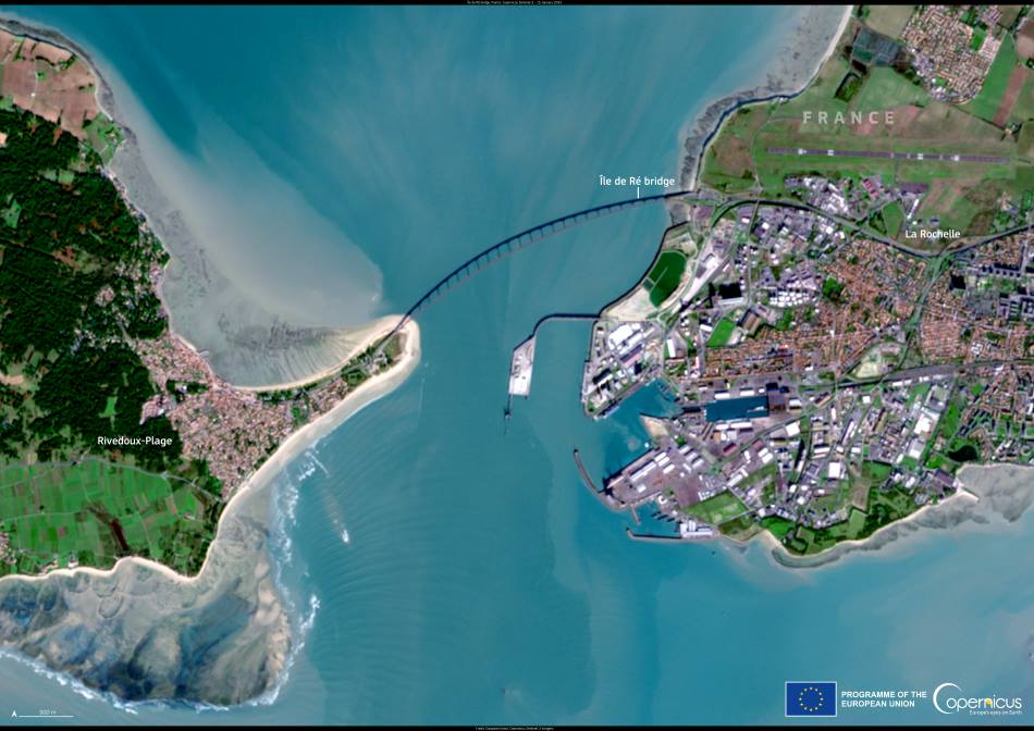
The Île de Ré Bridge (Pont de l’île de Ré) stands as a vital link between mainland France and the picturesque Île de Ré, captured in this Copernicus Sentinel-2 image acquired on 15 January 2025. Stretching approximately 3 kilometres across the Pertuis Breton strait, the bridge connects the historic port city of La Rochelle to the island’s rolling landscapes, salt marshes, and whitewashed villages.
Inaugurated in May 1988, the bridge has transformed accessibility to Île de Ré, which was previously reached only by ferry. Its construction marked a turning point for the island’s communities, helping to sustain year-round economic activity and shaping its development as a popular holiday destination. Today, visitors and residents cross the bridge to explore the island’s expansive network of cycling paths, charming harbors, and protected natural sites.

The bridge’s significance extends beyond transportation. Operated with an ‘eco-tax’ toll, it supports initiatives aimed at conserving Île de Ré’s fragile ecosystems. According to local authorities, revenues from the toll are reinvested in environmental protection measures, balancing the pressures of tourism with the island’s ecological preservation. More information about access to Île de Ré and the bridge’s eco-management efforts can be found through local tourism resources and Charente-Maritime’s official sites.
The Île de Ré Bridge stands as a reminder of how thoughtful infrastructure can enhance access while promoting sustainable stewardship of natural environments. Its slender arc, seen clearly from space, blends into the broader landscape of the Atlantic coast, where human presence and nature coexist.
Open data from the Copernicus Sentinel satellites provides detailed observations like this one, supporting urban planning, environmental management, and the protection of delicate coastal ecosystems across Europe.
Featured image credit: European Union, Copernicus Sentinel-2 imagery


