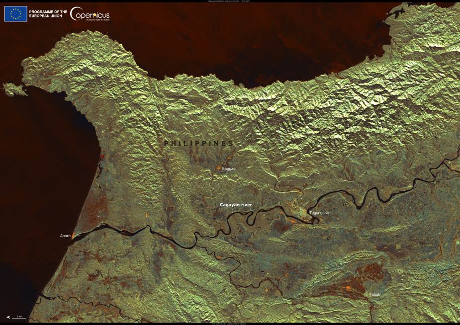
The Cagayan River, the longest and most voluminous river in the Philippines, winds across the northern island of Luzon for over 350 kilometers. Originating in the Cordillera Central mountain range, it flows northward through the fertile Cagayan Valley before emptying into the Babuyan Channel. This expansive river basin not only sustains rich biodiversity but also nourishes one of the country’s most important agricultural zones, providing vital irrigation to rice fields and other crops that support local communities.
A recent satellite image captured by Copernicus Sentinel-1 on 7 March 2025 offers a striking view of the river’s sinuous path through Luzon’s landscape. The image reveals the Cagayan River as it weaves past key towns such as Tuguegarao, Baggao, and Aparri. Above the river rise the rugged mountain ranges, while broad plains and agricultural lands unfold to the south, underscoring the river’s essential role in shaping both the geography and the livelihoods of the region.

Sentinel-1, part of the European Union’s Copernicus Earth observation program, provides high-resolution radar imagery that is invaluable for monitoring rivers and other water systems. Such data is crucial for sustainable water management, especially in areas like the Cagayan Valley that are prone to flooding and other climate-related risks.
In the Philippines, initiatives like CopPhil are helping turn these satellite insights into actionable strategies. As part of the EU’s Global Gateway strategy, CopPhil aims to build local capacity for using Copernicus data to manage biodiversity, improve hazard response, and strengthen climate resilience. By promoting open access to Earth observation tools, the project supports both environmental conservation and disaster preparedness in a region vulnerable to typhoons, droughts, and shifting weather patterns.
This image of the Cagayan River is more than a scenic snapshot — it’s a reminder of how satellite technology supports the sustainable management of the planet’s natural lifelines.
Featured image credit: European Union, Copernicus Sentinel-1 imagery


