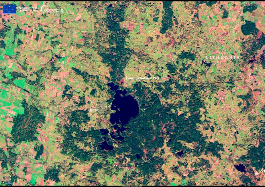
This satellite view captures Lithuania’s Žemaitija National Park, a protected area celebrated for its lakes, woodlands, and diverse wildlife. The image, taken by Copernicus Sentinel-2 on 18 October 2024, reveals the rich mosaic of forests and glacial lakes that define the region — including the expansive Lake Plateliai.
Situated in the northwestern part of Lithuania, Žemaitija National Park is part of the European Union’s Natura 2000 network — a system of over 25,000 protected areas designated under the EU Habitats and Birds Directives. These sites play a critical role in preserving rare and threatened species, as well as their habitats. Natura 2000 Day, marked each year on 21 May, is dedicated to recognizing these conservation efforts across Europe.
Žemaitija’s terrain is shaped by glacial activity, forming rolling hills and an intricate network of lakes and wetlands. Its ecosystems include mixed broadleaf forests, peat bogs, and aquatic habitats that support a variety of wildlife. Among the species protected within the park are the black stork and the lesser spotted eagle — both considered rare across much of their range in Europe.

The use of open satellite data, such as that provided by Copernicus, enhances conservation efforts by offering detailed and up-to-date views of Europe’s natural landscapes. This data is used to monitor changes in land cover, track biodiversity, and guide sustainable management practices for Natura 2000 sites.
The continued availability of Copernicus imagery supports not only scientific research but also policy decisions aimed at maintaining the ecological integrity of places like Žemaitija. As Europe reflects on its conservation achievements this Natura 2000 Day, the forests and lakes of Lithuania offer a vivid example of how satellite technology can help protect the continent’s natural heritage.
Featured image credit: European Union, Copernicus Sentinel-2 imagery


