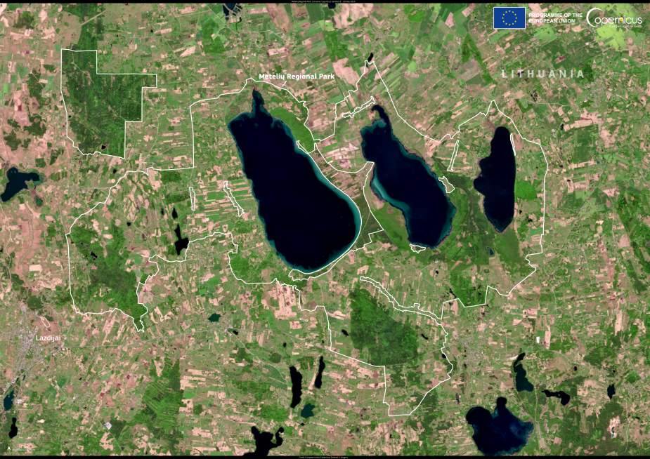
Meteliai Regional Park (Metelių regioninis parkas) in southern Lithuania stretches across more than 17,000 hectares of protected landscape, encompassing three of the country’s largest and most ecologically important lakes – Dusia, Metelys, and Obelija. This Copernicus Sentinel-2 image, captured on 20 May 2025, reveals the sweeping lakes and surrounding wetlands that define the park’s diverse terrain.
The region is a designated Natura 2000 site and serves as a critical haven for wildlife. Shallow waters, reedbeds, and wet meadows offer ideal breeding and resting grounds for migratory birds such as grebes, cranes, and loons. In autumn, lakes Dusia and Metelys host rare sea ducks, Red-throated Divers, and Black-throated Divers, while White-tailed Eagles patrol overhead. The ponds at nearby Simnas fishery farm attract large flocks of waders, including thousands of European Golden Plovers and Northern Lapwings, making the area a magnet for birdwatchers.

The lakes are also home to rare aquatic species, including the European pond turtle and the white-tailed sea eagle – the latter serving as a symbol of the park. A lone forest of oak trees in the Trakai area further enriches the ecological variety.
Recreational visitors to the park can follow cycling trails around the lakes or explore two marked hiking paths. The visitor centre on the southern shore of Lake Dusia provides exhibitions about the region’s natural heritage, along with guided tours and educational programs.
Free and open data from the Copernicus programme plays a vital role in tracking changes in the park’s ecosystems. Satellite imagery helps monitor water quality, vegetation health, and human impact, supporting long-term conservation across this biodiverse corner of Lithuania.
Featured image credit: European Union, Copernicus Sentinel-2 imagery


