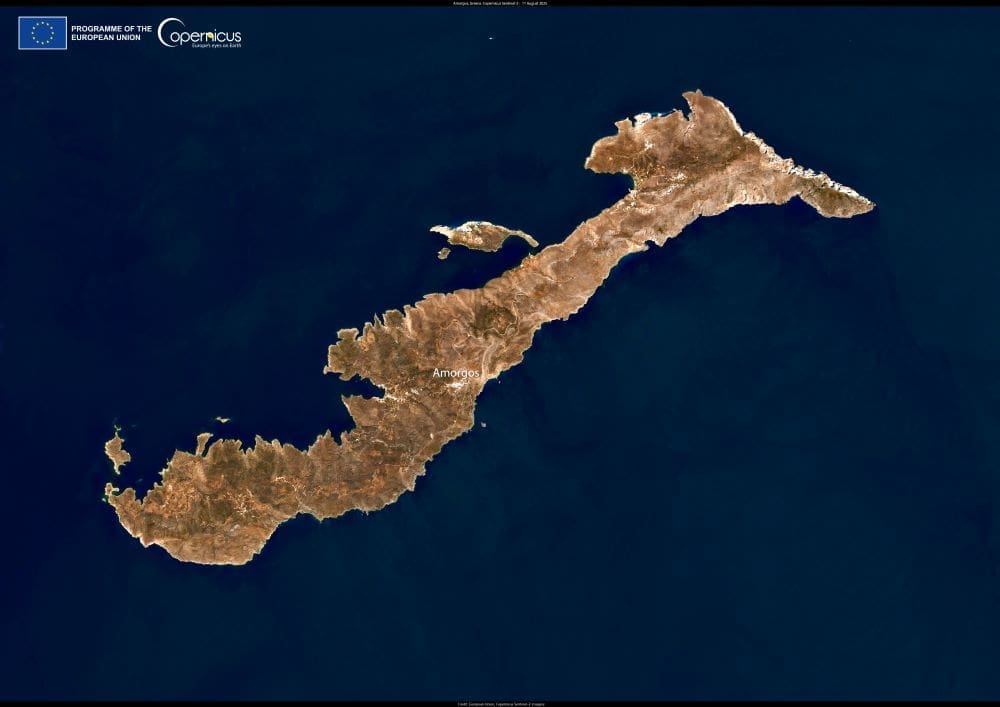
In the heart of the Southern Aegean, Amorgos stretches across the water as the easternmost island of the Cyclades, its elongated shape facing the smaller islands of the nearby Small Cyclades. With its rugged mountains and long coastline, the island has been a natural landmark and maritime link for centuries.
The terrain of Amorgos is defined by steep cliffs, rocky ridges, and footpaths that once served as vital connections between villages and monasteries. Along the shore, coves and sandy beaches open to clear blue waters, while inland routes wind through landscapes that have preserved much of their traditional Cycladic character.

This satellite image, captured on 11 August 2025 by one of the Copernicus Sentinel-2 satellites, shows calm seas surrounding the island. Such stillness is unusual for August, when the Etesian north winds, or meltemia, typically sweep across the Cyclades. These strong seasonal winds often roughen the seas and disrupt ferry services, shaping daily life for islanders and visitors.
Amorgos also carries a deep cultural legacy. Traces of habitation date back to the Early Cycladic period, and through antiquity the island was part of important seafaring routes. Today, its villages retain traditional architecture, offering continuity between ancient and modern life in the Aegean.
The image provides a rare seasonal perspective, capturing the island under calmer conditions at a time usually marked by strong winds. It offers both a geographical view of Amorgos and a reminder of the natural forces that influence life across the Cyclades.
Featured image credit: European Union, Copernicus Sentinel-2 imagery


