Hurricane Melissa, the strongest storm on the planet in 2025, rapidly intensified in the central Atlantic before sweeping across the Caribbean. The hurricane reached rare Category 5 status with sustained winds of 175 mph (282 km/h) and stronger gusts, according to the National Hurricane Center.
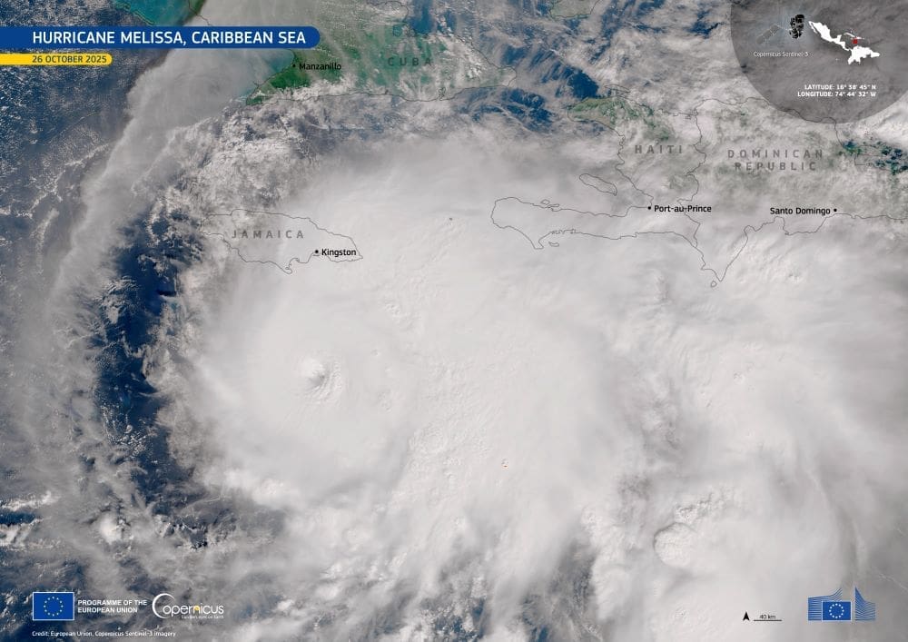
This image, captured by one of the Copernicus Sentinel-3 satellites on 26 October 2025, shows the distinct eye of Hurricane Melissa approximately 175 km south of Kingston, Jamaica. The storm’s tight spiral structure and clearly defined eye illustrate the extreme organization typical of high-end tropical cyclones.

Melissa’s outer bands were already lashing Jamaica with strong winds and heavy rain as mandatory evacuations were issued for coastal areas ahead of its expected landfall. Meteorologists warned of up to 40 inches of rain, 13 feet of storm surge, and sustained winds of 160 mph, conditions expected to cause “extensive infrastructure damage.” The storm has so far claimed at least seven lives across Haiti, Jamaica, and the Dominican Republic.
Copernicus Sentinel data plays a critical role in monitoring the environmental effects of tropical storms like Melissa. After landfall, satellite imagery helps map flooded regions, track coastal erosion, and assess impacts on ecosystems and land use – vital tools for emergency response and for strengthening long-term resilience to extreme weather.
Featured image credit: European Union, Copernicus Sentinel-3 imagery


