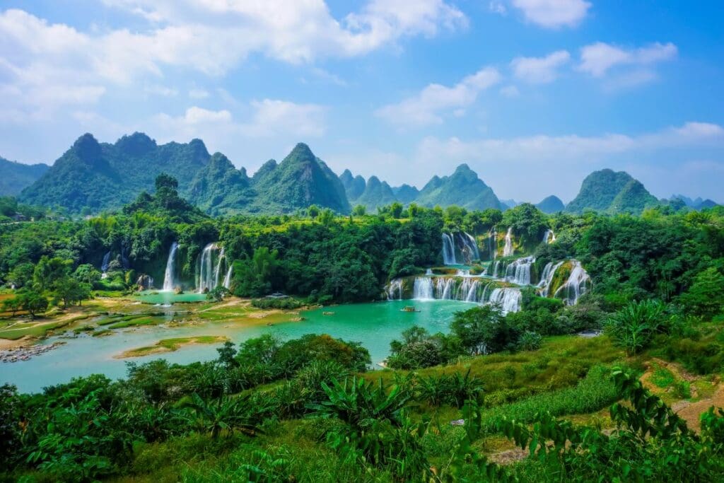
The Inland Delta of the Niger River (Delta Intérieur du Niger) in Mali, designated a Ramsar wetland of international importance in 2004, is among Africa’s largest and most dynamic inland floodplains. Extending from Ké Macina to Timbuktu and spanning more than four million hectares, the delta sustains nearly one million people through agriculture, fishing, and livestock grazing. Seasonal floods nourish the soil, replenish fisheries, and support an ecosystem that includes vulnerable species such as the hippopotamus (Hippopotamus amphibius), African manatee (Trichechus senegalensis), and black crowned crane (Balearica pavonina).
This Copernicus Sentinel-2 image, acquired on 10 October 2025, shows part of the Inland Delta near the edge of the Sahara, where parallel sand dunes remain exposed as the interdune depressions fill with floodwaters. The contrasting patterns of water and sand, visible from space, reveal the complex interaction between wind, water, and vegetation across the floodplain.

Beyond its ecological value, the Inland Delta plays an essential role in maintaining stability and livelihoods in central Mali. Its wetlands regulate floods, filter water, and provide food and grazing resources vital to surrounding communities. Yet the region faces increasing stress from upstream dams, shifting rainfall patterns, and rising competition over land and water. Efforts led by the Water, Peace, and Security (WPS) partnership – involving Wetlands International, IHE Delft, and the World Resources Institute (WRI) – have helped mitigate local tensions, including through the demarcation of pastoral routes and restrictions on harmful fishing gear.
Freely accessible Copernicus data contributes to monitoring these dynamic wetlands, supporting informed management and conservation of a landscape where environmental balance and human wellbeing are deeply intertwined.
Featured image credit: European Union, Copernicus Sentinel-2 imagery