Offshore wind farms in the North Sea are central to Europe’s clean energy expansion, supplying growing amounts of renewable energy while reducing reliance on imported fossil fuels. EU member states have agreed regional cumulative offshore goals in the ranges of 86–89 GW by 2030 and 356–366 GW by 2050, signalling how important offshore renewables will be to the continent’s power mix.
This part of the North Sea hosts dense clusters of Belgian and Dutch installations that take advantage of strong, consistent winds and relatively shallow waters – conditions that make large-scale arrays both technically and economically attractive. Offshore developments are used alongside other marine renewables such as tidal and wave energy to diversify supply and strengthen energy security.

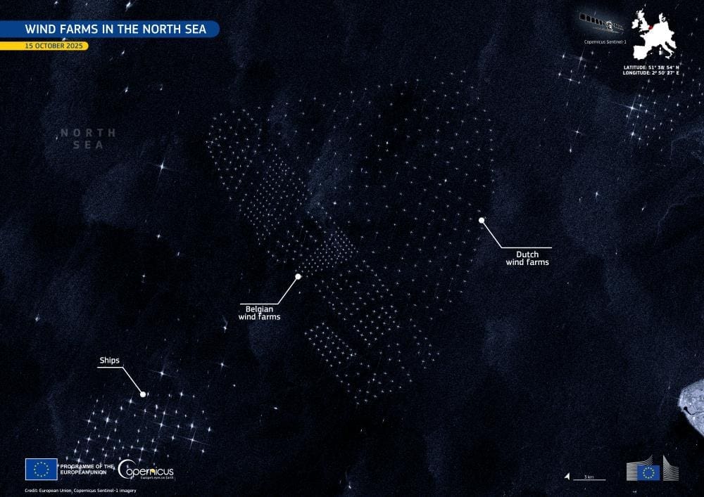
The Copernicus Sentinel-1 radar image, acquired on 15 October 2025, shows clusters of wind turbines as bright, structured formations on the sea surface; scattered light patterns reveal the presence of ships navigating around these installations.
Sentinel-1’s C-band synthetic-aperture radar provides day-and-night, all-weather imagery that is already used for planning, operational safety, and environmental monitoring in marine settings – from detecting vessel traffic to observing sea-surface conditions and wake effects near wind farms.
As offshore capacity grows – and turbine arrays expand farther from shore – routine satellite observations will remain essential for coordinating maritime activity, informing environmental assessments, and helping developers and authorities operate these installations safely and efficiently.
Featured image credit: European Union, Copernicus Sentinel-1 imagery


