The Istrian Peninsula sits at the northern edge of the Adriatic Sea, where Central Europe meets the Mediterranean. Shared by Croatia, Slovenia, and Italy, the region forms a compact but varied landscape shaped by limestone hills, shallow coastal waters, and a long, indented shoreline. This combination has made Istria an important ecological zone, linking terrestrial and marine ecosystems within a relatively small area.
Along the coast, rocky shores alternate with sheltered bays and wetlands. These waters support productive marine habitats that sustain fish populations and attract marine mammals. Bottlenose dolphins are regularly recorded in the northern Adriatic, using nearshore areas for feeding and social behaviour. Seabirds such as gulls, cormorants, and shearwaters are also closely tied to the coastline, relying on both open water and exposed rocks for foraging and resting. Inland, forests and grasslands contribute to regional climate regulation and provide corridors between coastal and upland habitats.

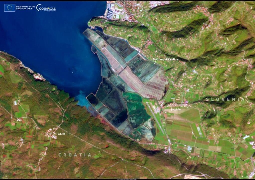
The peninsula is shown in this Copernicus Sentinel-2 image acquired on 5 November 2025. Vegetation appears in bright shades of green across inland areas, while the Adriatic Sea is rendered in deep blues, with lighter tones near the coast revealing shallow waters and sediment patterns. The contrast between land and sea highlights the close connection between terrestrial landscapes and marine processes that define Istria’s environment.
Further south, protected areas such as Cape Kamenjak illustrate how small-scale reserves can safeguard biodiversity hotspots. These coastal zones are used by migratory birds and support sensitive marine life, including sea turtles like the loggerhead, which is native to the Adriatic. Seasonal conditions, currents, and human activity all influence how wildlife uses these spaces.
Copernicus Sentinel data are widely used to observe such coastal regions over time. By tracking changes in vegetation cover, water quality, and shoreline dynamics, satellite imagery supports environmental monitoring and helps authorities assess pressures on ecosystems that are both biologically rich and closely linked to human activity.
Featured image credit: European Union, Copernicus Sentinel-2 imagery